Looks like severe weather is about to start exploding over parts of eastern Arkansas, northern Mississippi, and western Tennessee. In that general area, the CAPE has gotten up over 1500 J/kg and the helicity is over 400 m2/s2.
A tornado watch will be issued shortly. In those areas mentioned especially, a few violent tornadoes are possible.
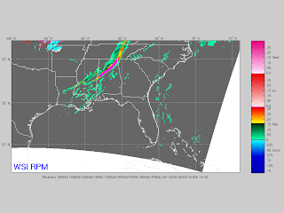
Later this evening and tonight, the activity will congeal into a squall line and move eastward through the Deep South. Places such as Nashville, Huntsville, Birmingham, Atlanta, Montgomery, and Meridian could see some damaging winds along that line of storms as well as some brief tornadoes embedded within the line.
Here is a frame from the RPM model valid at 2:30am CST.

Tidak ada komentar:
Posting Komentar