Tampilkan postingan dengan label heavy rain potential. Tampilkan semua postingan
Selasa, 28 Juni 2011
Off & On Thunder Threat Today
The muggies are back today -- it won't be oppressively hot out today but humidity levels will be high enough today to bring a summery feel to the region. Along with more humidity is a risk for thunderstorms throughout the day. Radar is already picking them up out to the west -- showers and storms in Maryland and Southwest Pennsylvania are slowly working east this morning and we'll see some of that activity around here in a few hours if they hold together.
After whatever amounts from this morning's activity moves through, off and on sun will greet us through the day, further destabilizing the atmosphere and allowing for more thunderstorm development this afternoon. While (as of this morning) there is no declared risk of severe weather from the Storm Prediction Center, this airmass yields the potential of a few storms reaching severe criteria later on today in Pennsylvania. The threat of localized heavier downpours exists as well and may ultimately be the bigger threat, not damaging winds (although those can't be ruled out). Thunderstorm development looks to be scattered in nature (see below), with the focal point generally starting in Central Pennsylvania and then working east or east-northeast. Models are uncertain about how widespread the thunder threat is and exact timing, with the NAM a bit later compared to the GFS on firing stuff up. Odds, however, favor late afternoon through late evening (5-11 PM) locally for storms to move through, which means the Phils' game could have some delays if the timing is "right."
More: Current Weather Page
Senin, 27 Juni 2011
Potential For Strong Storms Tomorrow
With a frontal boundary working east tomorrow into our region, warmth and humidity will provide the spark necessary for thunderstorm development during the afternoon and evening hours. Questions linger regarding how much rain is possible but there is some potential for heavy rain around the region as these storms develop tomorrow and march east.
Modeling is indecisive about the exact location of heavy rainfall -- the NAM (see below) places the heaviest and strongest thunderstorm activity to our north while the GFS places it to our south. The Euro doesn't give any one spot overly heavy rainfall but plants a general swath of half inch rains from tomorrow's thunderstorms. Predicting exactly where summertime thunder drops heavy rain is a low confidence prediction more often than not but noting that more computer models than not are showing the threat for heavy rainfall tomorrow afternoon and evening is worth bringing up. Some spots could see an inch plus of rain -- if it is Philly or south, the rain will be quite welcome as things locally have been a bit dry of late.
We could see thunderstorms locally as early as later tonight as a warm front associated with this system lifts northeast up the coast. Thunder could break out this afternoon to our south in Virginia and lift northeast slowly this evening along the coast or across New Jersey. However, the main burst of activity should be later tomorrow with the front crossing the region.
Some of tomorrow's storms could potentially go severe, especially north/west of the city. Odds don't favor a widespread outbreak of severe as dynamics with the front aren't all that great but with a humid atmosphere and temperatures in the mid and upper 80's the potential does exist for some stronger thunderstorms in the afternoon hours.
Modeling is indecisive about the exact location of heavy rainfall -- the NAM (see below) places the heaviest and strongest thunderstorm activity to our north while the GFS places it to our south. The Euro doesn't give any one spot overly heavy rainfall but plants a general swath of half inch rains from tomorrow's thunderstorms. Predicting exactly where summertime thunder drops heavy rain is a low confidence prediction more often than not but noting that more computer models than not are showing the threat for heavy rainfall tomorrow afternoon and evening is worth bringing up. Some spots could see an inch plus of rain -- if it is Philly or south, the rain will be quite welcome as things locally have been a bit dry of late.
We could see thunderstorms locally as early as later tonight as a warm front associated with this system lifts northeast up the coast. Thunder could break out this afternoon to our south in Virginia and lift northeast slowly this evening along the coast or across New Jersey. However, the main burst of activity should be later tomorrow with the front crossing the region.
Some of tomorrow's storms could potentially go severe, especially north/west of the city. Odds don't favor a widespread outbreak of severe as dynamics with the front aren't all that great but with a humid atmosphere and temperatures in the mid and upper 80's the potential does exist for some stronger thunderstorms in the afternoon hours.
Selasa, 26 April 2011
Thunder Chances Before Thursday's Main Event
The current severe weather event across the central portions of the country is rather amazing -- the damage in St. Louis to their airport last Friday, the run of storms through Arkansas yesterday, and over 15" of rain in some portions of the Ozarks from the current pattern has been remarkable to watch unfold. This storm system is finally easing east and will work towards us for Thursday. However, it will be close enough to us tomorrow to increase the odds of thunder around the region.
A slight risk of severe weather was placed out for the region for Wednesday for areas west of Philadelphia, with the highest concentration of severe thunderstorms in the Ohio Valley down into the Mid South, including Nashville, Louisville, and parts of Alabama. Our severe risk is more for Wednesday night if the storms move quickly enough, with the main focus area for severe weather on Thursday positioned squarely over the top of us as the front closes and crosses the region.
Despite the worst of storms being to our west tomorrow, there will be an added risk for showers and thunderstorms as the atmosphere is increasingly unstable the mid level cap that was over us on Monday and most of Tuesday weakens as high pressure's grip over the region weakens somewhat. The strong southwest flow at the lower levels and mid levels of the atmosphere will help tug tropical moisture that is east of Florida and Georgia northward into the region on Wednesday. This will increase the thunder risk and probably lower our daytime temperatures by several degrees. While it will still be warm, the additional clouds will keep us from getting into the 80's like we have the past three days. Some showers and storms will develop and move through the region over the course of the day, some of which may produce heavy rainfall due to the quasi-tropical airmass that will be in place.
Storms will be scattered in nature and move through from southwest to northeast during the day and ahead of Thursday's main event, which continues to show signs of being a rather potent event whether it be a wind threat or heavy rain threat...both of which are definitely possible as a squall line may develop along the cold front Thursday afternoon.
Hopefully you have been able to enjoy most of the past three days -- while the weather hasn't been 100% perfect all of the time the past few, it's been the best weather we've had in a while. Unfortunately, things will head downhill from here...especially on Thursday.
A slight risk of severe weather was placed out for the region for Wednesday for areas west of Philadelphia, with the highest concentration of severe thunderstorms in the Ohio Valley down into the Mid South, including Nashville, Louisville, and parts of Alabama. Our severe risk is more for Wednesday night if the storms move quickly enough, with the main focus area for severe weather on Thursday positioned squarely over the top of us as the front closes and crosses the region.
Despite the worst of storms being to our west tomorrow, there will be an added risk for showers and thunderstorms as the atmosphere is increasingly unstable the mid level cap that was over us on Monday and most of Tuesday weakens as high pressure's grip over the region weakens somewhat. The strong southwest flow at the lower levels and mid levels of the atmosphere will help tug tropical moisture that is east of Florida and Georgia northward into the region on Wednesday. This will increase the thunder risk and probably lower our daytime temperatures by several degrees. While it will still be warm, the additional clouds will keep us from getting into the 80's like we have the past three days. Some showers and storms will develop and move through the region over the course of the day, some of which may produce heavy rainfall due to the quasi-tropical airmass that will be in place.
Storms will be scattered in nature and move through from southwest to northeast during the day and ahead of Thursday's main event, which continues to show signs of being a rather potent event whether it be a wind threat or heavy rain threat...both of which are definitely possible as a squall line may develop along the cold front Thursday afternoon.
Hopefully you have been able to enjoy most of the past three days -- while the weather hasn't been 100% perfect all of the time the past few, it's been the best weather we've had in a while. Unfortunately, things will head downhill from here...especially on Thursday.
Sabtu, 16 April 2011
Flood Watches Up N/W of I-95
A rather crappy weather day is about to unfold across the region as that significant storm system that brought tornado watches to nine states and dropped 80 reported tornadoes across the country is now setting its march on the Mid Atlantic. While tornadoes are not likely by any stretch here, a rather wind swept and rainy Saturday afternoon and evening is. The likelihood for at least an inch of rain for nearly everyone, with some two inch amounts north of the city, is setting up the possibility of some flooding in some locations. Flood Watches are out for places north/west of I-95 in Pennsylvania, Delaware, and New Jersey for tonight as soil conditions are still moist and a heavy shot of rain is expected in short duration this evening.
Radar (below) this morning is showing the first waves of rain moving into the area from the west. We should be able to coax a few dry hours this morning before showers spread in later, followed by heavier rains as we work towards dinner. The worst of the storm won't be until this evening -- but a six hour period from 6 PM - Midnight will provide a rather wild stretch of rain, thunder, perhaps strong gusty winds in those storms.
A slight risk of severe weather is out for Delaware, Southwest New Jersey, and South Central Pennsylvania -- generally points south and west of the city -- as a bit of a low pressure wave rides along the advancing front today and helps enhance thunderstorm activity. North of the wave, rain may be heaviest and those two inch amounts of rain could fall across Eastern Pennsylvania and Northwest New Jersey. South/east of the wave is where thunderstorms could bring some strong wind gusts to the mix. The GFS (below) shows the heavy rain blob generally north of the Philadelphia area at the height of the storm, between 8 and 11 PM. Over an inch of rain may fall in just three hours. The Euro (not shown) also is suggesting the heaviest of rains ride north/west of the city along and north of this wave of low pressure.
The NAM is showing the potential for torrential rains south/east of the low. While that's possible, the NAM does have a tendency to overdo thunderstorm-induced rainfall. It's possible that the storms may be wild and wacky, the rainfall results may not be as robust south of the city as they are to the north.
In a nutshell, expect a breezy and raw Spring day. Conditions will continue to go downhill as the storm moves in later on, with rain increasing in coverage later on today and becoming heavy at times towards dinner. Thunderstorms can't be ruled out and some of the storms will be pretty nasty from the city on south.
More: Current Weather Page
Radar (below) this morning is showing the first waves of rain moving into the area from the west. We should be able to coax a few dry hours this morning before showers spread in later, followed by heavier rains as we work towards dinner. The worst of the storm won't be until this evening -- but a six hour period from 6 PM - Midnight will provide a rather wild stretch of rain, thunder, perhaps strong gusty winds in those storms.
A slight risk of severe weather is out for Delaware, Southwest New Jersey, and South Central Pennsylvania -- generally points south and west of the city -- as a bit of a low pressure wave rides along the advancing front today and helps enhance thunderstorm activity. North of the wave, rain may be heaviest and those two inch amounts of rain could fall across Eastern Pennsylvania and Northwest New Jersey. South/east of the wave is where thunderstorms could bring some strong wind gusts to the mix. The GFS (below) shows the heavy rain blob generally north of the Philadelphia area at the height of the storm, between 8 and 11 PM. Over an inch of rain may fall in just three hours. The Euro (not shown) also is suggesting the heaviest of rains ride north/west of the city along and north of this wave of low pressure.
The NAM is showing the potential for torrential rains south/east of the low. While that's possible, the NAM does have a tendency to overdo thunderstorm-induced rainfall. It's possible that the storms may be wild and wacky, the rainfall results may not be as robust south of the city as they are to the north.
In a nutshell, expect a breezy and raw Spring day. Conditions will continue to go downhill as the storm moves in later on, with rain increasing in coverage later on today and becoming heavy at times towards dinner. Thunderstorms can't be ruled out and some of the storms will be pretty nasty from the city on south.
More: Current Weather Page
Jumat, 15 April 2011
Wild Weather Expected Tonight: Wind, Heavy T-Storms Expected

The number as of 12:02 a.m. stands at 80! 80 tornadoes that is! The largest tornado outbreak of the year continues at this late hour in the Southeast. The majority of these tornadoes occurred so far in Mississippi, Alabama, and Missouri, and Illinois. Tornado watches continue at this hour for additional states and we may be adding to these numbers throughout the early morning hours. Based on the reports, it does appear a few strong tornadoes occurred. There have been fatalities and injuries with some of the tornadoes.

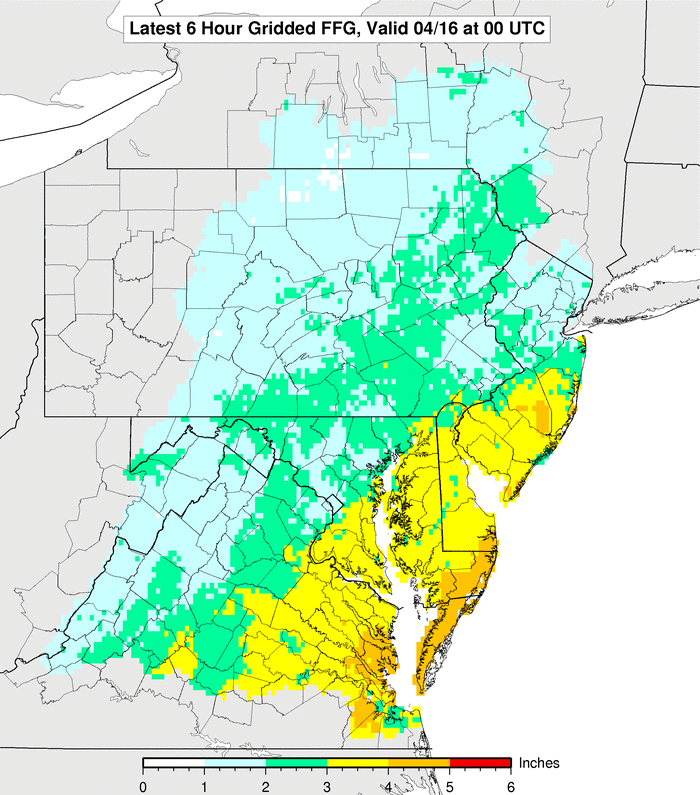
The same potent storm system is anticipated to impact our region today, Saturday. For our region, we will not see the widespread tornado outbreak. However, we may be dealing with thunderstorms that could contain damaging wind gusts. Right now, the Storm Prediction Center has the slight risk for severe thunderstorms only including Southern Delaware. I think it is possible that they will extend the risk area further northward in later outlooks. The North American Model and some of the high resolution models show clearly that a line of convection… pushing from west to east between 8:00 p.m. and 11:00 p.m. …will impact the region. The NAM has widespread purple coloring indicating a quick 1.50 to 1.75 inches of rain in less than six hours during the time frame of convection which I suspect may lead to some localized flash flooding. Total rainfall of 1.75 to 2.50 inches looks to be a good bet for much of the region. Bucks, Montgomery, Eastern Berks, and Eastern Lehigh Counties into North-Central New Jersey need 1 to 2 inches in less than 6 hours for flash flooding to begin. Elsewhere in Pennsylvania…2 to 3 inches of rain would be needed for flash flooding to begin. In Southern New Jersey, rainfall amounts of 3 to 4 inches would be needed for flash flooding to begin and the sandier soil will make this area less vulnerable to flooding. If the NAM is correct, the heaviest rain would be right over the Delaware River and Interstate 95 corridor. I wouldn’t be surprised if some flash flood warnings or a flash flood watch is posted for the more vulnerable counties.
Basically, a low will develop a cold front pushing towards our region. The low will energize the front. Moisture will be streaming in from the fetch off the Atlantic and combine with the Gulf Moisture that is open for business. All of this suggests a super soaking.

We also will be dealing with wind issues that are non-convective related. We have had some decent soakings and this will be another one. The ground will be wet enough to be supportive of an increased risk for trees to become uprooted in strong winds. Unfortunately, it looks like the jet intensifies by mid-evening during the timing of the heavy rain which could transfer the momentum down to the surface. Non-thunderstorm wind gusts of 40 to 50 MPH appear likely, perhaps higher than 50 MPH along the coastline. The National Weather Service has issued a wind advisory which implies sustained winds of 31 to 39 MPH or frequent wind gusts of 46 to 57 MPH are imminent or occurring. This is in effect from noon today until midnight tonight. The gradient looks tight enough that even when it is not raining...gusts of around 45 MPH will occur.
The strong onshore winds will also pose a risk for widespread minor coastal flooding, with scattered areas of moderate coastal flooding. A coastal flood watch has been issued for the tidal areas of the Delaware River and the entire New Jersey/Delaware Atlantic coastline.
We will have continuing coverage of the potential wild weather throughout the day here on phillyweather.net.
Selasa, 12 April 2011
Flipping, Flopping, Temperatures & Raindrops Dropping
A warm, somewhat summery early morning in the Philadelphia region as temperatures are in the 60's just about everywhere. The promised cold front is slow in its approach and taking its sweet time getting through the region, having just crossed Philadelphia and Wilmington in the last couple of hours. It'll take a while for the cooldown to kick in, especially since winds are northwest this morning, but the 60's that we're experiencing going out the door will likely not be the case this afternoon around here as rain should sweep into the region later on today. This morning won't be so bad but rain should pick up to the north/west over the next couple of hours, with the heaviest of rains for the rest of us likely late this afternoon through Midnight tonight.
Radar above shows light rain extending along Blue Mountain back into Central and Western Pennsylvania, where rains are steadier along the Appalachians. Most of this morning's rains should generally stay confined to Philly and north. An upper level low is back in the Ohio Valley and is responsible for today's downward spiral in the weather as rain pivots east later on, hitting the rest of the area after the lunch hours, with the brunt of the storm expected for the evening commute and this evening. Rainfall could exceed an inch, perhaps an inch and a half in some spots, as surface low pressure intensifies and pulls in Atlantic moisture that will squeeze out over the region. The intensifying low will also pull in cooler air off of the ocean and help drop temperatures...slowly at first later this morning, then in earnest this afternoon. Temperatures could be in the low 50's for the evening commute.
The other story will be gusty winds with the intensifying surface low. Winds could gust to 40 mph along the coast, to 35 mph inland, after 2 PM today. Compared to yesterday's mid 80's across inland areas, the return of less than stellar weather continues our agonizing march to Spring.
More: Current Weather
Radar above shows light rain extending along Blue Mountain back into Central and Western Pennsylvania, where rains are steadier along the Appalachians. Most of this morning's rains should generally stay confined to Philly and north. An upper level low is back in the Ohio Valley and is responsible for today's downward spiral in the weather as rain pivots east later on, hitting the rest of the area after the lunch hours, with the brunt of the storm expected for the evening commute and this evening. Rainfall could exceed an inch, perhaps an inch and a half in some spots, as surface low pressure intensifies and pulls in Atlantic moisture that will squeeze out over the region. The intensifying low will also pull in cooler air off of the ocean and help drop temperatures...slowly at first later this morning, then in earnest this afternoon. Temperatures could be in the low 50's for the evening commute.
The other story will be gusty winds with the intensifying surface low. Winds could gust to 40 mph along the coast, to 35 mph inland, after 2 PM today. Compared to yesterday's mid 80's across inland areas, the return of less than stellar weather continues our agonizing march to Spring.
More: Current Weather
Rabu, 09 Maret 2011
Make It Rain
The first fingers of the storm are starting to move in, with a major storm system will pump in Atlantic moisture on southeast winds. Breezy, rainy, and then a torrent of sogginess forthcoming as the combination of Atlantic moisture and the storm system working in leads to a significant rain event over the next 36 hours. Tonight and early tomorrow will be rainy and it will be inconvenient in terms of impact but it will not be the worst of the storm. As you can tell on the radar most precipitation tonight is pretty light although heavier precipitation will train northward starting tomorrow afternoon.
The storm system will progress slowly through the region -- due in part to a blocking high pressure center in the Atlantic aloft and at the surface, which will prevent a fast movement of the storm through the region. Due to this slow movement, we'll see rain push northward during Thursday afternoon and evening in a "train" like fashion, covering the same areas repeatedly. This rainfall from midday Thursday through Friday morning will be the problem causer in the Delaware Valley and where we will pick up quite a bit of rain. Some thunder can't be ruled out during the storm either -- particularly on Thursday evening.
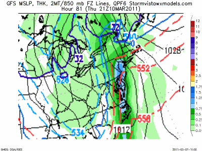
If the NAM is correct, some places see five inches of rain before the storm ends on Friday morning, with most of the region getting at least two inches of rain. The lightest parts of the storm will persist in coastal parts of New Jersey and Delaware, with rainfall totals between an inch or two inches. Most of Eastern Pennsylvania and North Jersey will see two to three inches, with some isolated higher amounts.
Flooding is likely on streams throughout the Delaware Valley -- including the Delaware River. Flood levels are potentially going to reach those hit in the wake of Hurricane Ivan in 2004 along the Delaware according to the National Weather Service. In addition to the flooding potential in streams, roadways are going to have some flood issues to deal with as well, particularly vulnerable roads around town.
I'll have an update on the system tomorrow morning.
The storm system will progress slowly through the region -- due in part to a blocking high pressure center in the Atlantic aloft and at the surface, which will prevent a fast movement of the storm through the region. Due to this slow movement, we'll see rain push northward during Thursday afternoon and evening in a "train" like fashion, covering the same areas repeatedly. This rainfall from midday Thursday through Friday morning will be the problem causer in the Delaware Valley and where we will pick up quite a bit of rain. Some thunder can't be ruled out during the storm either -- particularly on Thursday evening.
If the NAM is correct, some places see five inches of rain before the storm ends on Friday morning, with most of the region getting at least two inches of rain. The lightest parts of the storm will persist in coastal parts of New Jersey and Delaware, with rainfall totals between an inch or two inches. Most of Eastern Pennsylvania and North Jersey will see two to three inches, with some isolated higher amounts.
Flooding is likely on streams throughout the Delaware Valley -- including the Delaware River. Flood levels are potentially going to reach those hit in the wake of Hurricane Ivan in 2004 along the Delaware according to the National Weather Service. In addition to the flooding potential in streams, roadways are going to have some flood issues to deal with as well, particularly vulnerable roads around town.
I'll have an update on the system tomorrow morning.
Label:
flood potential,
flood watches,
heavy rain potential,
NAM
Selasa, 08 Maret 2011
Slapped With Rain
We're about 30-36 hours away from the next storm moving on in, timed to start on Wednesday night with rain for most and some sleet and possibly snow in the Poconos. Computer modeling continues to suggest the potential for a very heavy rain event, although the models differ a bit on timing and details. The Canadian and some short-range supplemental guidance suggest a much slower evolution of the storm and a more robust mid level feature, which will cut off and enhance the rainfall to the level of several inches as the system lingers through Friday. However, those models are the exception. Most computer guidance as of this afternoon suggests that the storm system will provide a significant amount of rain but shoot the system through the region more quickly, either by late Thursday night or early Friday morning.
Both scenarios (the slower Canadian and the faster ones everyone else is depicting) suggest the heaviest of rains fall Thursday late afternoon through the evening...with the Canadian and slower forecasts suggesting heavy rain will linger into Friday morning due to the slower track and cut-off feature.
Between the GFS and the Euro computer models, the potential exists for 2-3" of rain across Pennsylvania, with a bit less rainfall south/east of the city (generally an inch can't be ruled out at the Shore), with the Canadian suggesting as much as four inches of rain from the storm over a larger chunk of the region. This type of rain, regardless of the two inch scenario or four inch, will cause flooding. With the heavier rainfall focusing to our north and west, this will impact the Delaware and Schuylkill River basins.
Both scenarios (the slower Canadian and the faster ones everyone else is depicting) suggest the heaviest of rains fall Thursday late afternoon through the evening...with the Canadian and slower forecasts suggesting heavy rain will linger into Friday morning due to the slower track and cut-off feature.
Between the GFS and the Euro computer models, the potential exists for 2-3" of rain across Pennsylvania, with a bit less rainfall south/east of the city (generally an inch can't be ruled out at the Shore), with the Canadian suggesting as much as four inches of rain from the storm over a larger chunk of the region. This type of rain, regardless of the two inch scenario or four inch, will cause flooding. With the heavier rainfall focusing to our north and west, this will impact the Delaware and Schuylkill River basins.
Senin, 07 Maret 2011
Ark Busting Rains?
We have a couple of days to dry off and shake the water out of our boots before round two moves in on Thursday. Computer modeling is showing the potential for another soaking rainfall in the Philadelphia region as a storm system is poised to lift northeast through the Appalachians and Northeast as the parade of storms continues along the East Coast over the coming weeks.
The worst of the storm looks to move in during Thursday's midday and afternoon hours -- and if the GFS is correct is looks like the potential for an inch of rain during the day Thursday along I-95, with rain starting during the early morning hours on Thursday, which means the commute to and from work will be slow, drenching, and not a fun ride for anyone in the Philadelphia region. Rain may start (not finish) this time as snow or sleet across the Poconos (the Euro and NAM depict this scenario) as dry air from high pressure remains entrenched and helps cool the atmosphere as precipitation moves in. As moisture streams in from the Atlantic on Thursday, the transition from frozen to non-frozen will take place quickly in the Poconos although temperatures up there will be chilly during the event, probably staying in the 30's or perhaps low 40's.
This will be a cooler storm, especially north and west of the city while some of the influence of the high will keep temperatures down a touch. Computer modeling is suggesting the potential for two to four inches of rain in parts of the region, especially if the Euro is correct, and that type of rainfall could yield some significant flooding in parts of the region, particularly along the Delaware River where there's some minor flooding already taking place. Timing-wise, the Euro is the slowest (Thursday into Thursday night) while the GFS has the system clearing out Thursday evening.
Other guidance paints similar rainfall totals although the GFS paints the heaviest rains over I-95 while the Euro paints it to the north and west. In either scenario, the models are painting a pretty heavy rain event for Thursday across the region.
The worst of the storm looks to move in during Thursday's midday and afternoon hours -- and if the GFS is correct is looks like the potential for an inch of rain during the day Thursday along I-95, with rain starting during the early morning hours on Thursday, which means the commute to and from work will be slow, drenching, and not a fun ride for anyone in the Philadelphia region. Rain may start (not finish) this time as snow or sleet across the Poconos (the Euro and NAM depict this scenario) as dry air from high pressure remains entrenched and helps cool the atmosphere as precipitation moves in. As moisture streams in from the Atlantic on Thursday, the transition from frozen to non-frozen will take place quickly in the Poconos although temperatures up there will be chilly during the event, probably staying in the 30's or perhaps low 40's.
This will be a cooler storm, especially north and west of the city while some of the influence of the high will keep temperatures down a touch. Computer modeling is suggesting the potential for two to four inches of rain in parts of the region, especially if the Euro is correct, and that type of rainfall could yield some significant flooding in parts of the region, particularly along the Delaware River where there's some minor flooding already taking place. Timing-wise, the Euro is the slowest (Thursday into Thursday night) while the GFS has the system clearing out Thursday evening.
Other guidance paints similar rainfall totals although the GFS paints the heaviest rains over I-95 while the Euro paints it to the north and west. In either scenario, the models are painting a pretty heavy rain event for Thursday across the region.
Minggu, 27 Februari 2011
More Rain, More Storms, More Warmth Monday
Another strong storm system will push through the Northeast and the slight risk of severe weather continues to hold for the Mid Atlantic. The highest odds for severe weather will be to our south and west but around here there is a 15% chance that severe weather could occur near the city. For February, it's impressive to have two slight risks in four day's time around these parts. With a warm surge of temperatures and instability pushing north ahead of a strong storm system, the atmosphere will be ripe for storms but also heavy rain.
Rain could be significant across the Mid Atlantic with the storm impacting us in two waves. The first, in association with a warm front, brings more rain to the north and west of the city than elsewhere but rain and some spring-like thunder can't be ruled out after midnight from southwest to northeast across the region. Rainfall could total an inch across parts of Central into Northeastern Pennsylvania overnight and during the morning hours on Monday. We probably will not see that type of rainfall tonight around Philadelphia but we could see a period of rain/thunder to start off Monday.
The warm front lifts north and Southeastern Pennsylvania, Central and South Jersey, and Delaware will get into a break between round one (warm front-enhanced rains) and round two (cold front). Rains may continue across the Poconos and Central Pennsylvania, perhaps grazing the Lehigh Valley and Berks from time to time on Monday. The "break" is critical for severe weather prospects as computer guidance is hinting at soaking thunderstorms developing or moving in after 4 PM. If we get enough sunshine we could see temperatures approach 70 in Philadelphia (record high is 68) but even without sun, we should get into the 60's. With an unstable atmosphere and decent dynamics aloft, the potential does exist for those storms to pop. If you look at the higher resolution radar below you can see the heaviest activity is across South Jersey, Delaware, and Maryland. The activity over Maryland will spread into Southeastern Pennsylvania over the course of the early evening.
With the storminess developing along the front and lifting northeast as the front slides east, the potential for upwards of two inches of rain exists for some parts of the region from tomorrow's storms. The heaviest rain may ultimately fall in pockets as the cold front enhanced storms may develop in segments and not a solid line that sweeps through and hits everyone (see the precip totals on the graphic above), typical of a more "summery" thunderstorm setup.
We'll have another update in the morning hours on Monday.
More: Current Weather Page
Rain could be significant across the Mid Atlantic with the storm impacting us in two waves. The first, in association with a warm front, brings more rain to the north and west of the city than elsewhere but rain and some spring-like thunder can't be ruled out after midnight from southwest to northeast across the region. Rainfall could total an inch across parts of Central into Northeastern Pennsylvania overnight and during the morning hours on Monday. We probably will not see that type of rainfall tonight around Philadelphia but we could see a period of rain/thunder to start off Monday.
The warm front lifts north and Southeastern Pennsylvania, Central and South Jersey, and Delaware will get into a break between round one (warm front-enhanced rains) and round two (cold front). Rains may continue across the Poconos and Central Pennsylvania, perhaps grazing the Lehigh Valley and Berks from time to time on Monday. The "break" is critical for severe weather prospects as computer guidance is hinting at soaking thunderstorms developing or moving in after 4 PM. If we get enough sunshine we could see temperatures approach 70 in Philadelphia (record high is 68) but even without sun, we should get into the 60's. With an unstable atmosphere and decent dynamics aloft, the potential does exist for those storms to pop. If you look at the higher resolution radar below you can see the heaviest activity is across South Jersey, Delaware, and Maryland. The activity over Maryland will spread into Southeastern Pennsylvania over the course of the early evening.
With the storminess developing along the front and lifting northeast as the front slides east, the potential for upwards of two inches of rain exists for some parts of the region from tomorrow's storms. The heaviest rain may ultimately fall in pockets as the cold front enhanced storms may develop in segments and not a solid line that sweeps through and hits everyone (see the precip totals on the graphic above), typical of a more "summery" thunderstorm setup.
We'll have another update in the morning hours on Monday.
More: Current Weather Page
Flood Watches For Monday PM For Some
Another slug of rain and wind are on the way, with potentially over an inch of rain in the offing for Monday afternoon and evening. Due to the low tolerance of streams and watersheds to handle water in the northern and western suburbs, a flood watch is out for Monday PM for Southeastern Pennsylvania and three counties in Central New Jersey.
In some of these counties, the ground is pretty well soaked and flood guidance is just over an inch of rain in a six hour period. As thunderstorms are poised to develop on Monday afternoon and evening, heavy rainfall could sweep through these waterlogged counties and lead to some stream flooding, ponding of water on roadways, and water collecting in low lying areas.
Computer guidance is suggesting upwards of two inches of rain Monday evening in some locations, with the northern and western suburbs under the gun for the heaviest rainfall as of last night's guidance.
We'll have a more thorough update on the storm's potential to bring heavy rain, severe weather, and a surge of warmth in advance of all of this "fun" in a post later on today.
In some of these counties, the ground is pretty well soaked and flood guidance is just over an inch of rain in a six hour period. As thunderstorms are poised to develop on Monday afternoon and evening, heavy rainfall could sweep through these waterlogged counties and lead to some stream flooding, ponding of water on roadways, and water collecting in low lying areas.
Computer guidance is suggesting upwards of two inches of rain Monday evening in some locations, with the northern and western suburbs under the gun for the heaviest rainfall as of last night's guidance.
We'll have a more thorough update on the storm's potential to bring heavy rain, severe weather, and a surge of warmth in advance of all of this "fun" in a post later on today.
Jumat, 25 Februari 2011
Freaky Friday
The morning radar and temperature overlay is showing a "lull" between rounds -- this looks like a three round event at play as round one has lifted through most of the city and is about to lift through Bucks and the eastern suburbs, and round two is approaching us from the west in Central Pennsylvania. In the interim, a couple of "dry" hours except for spray on the roads. Temperatures this morning are pretty much in line with what we thought as a warm front lurks just to our south -- 40's in place around town this morning, with 50's in Lower Delaware, and 30's in the Poconos where icy rain has fallen for much of the evening.
The radar look on the left shows a bit of a wider view of the incoming storm and the other two rounds. Round two is the batch in Central Pennsylvania in association with surface low pressure that will ride east-northeast through the state today. As this moves through later this morning, expect a round of rain to come back in (probably after 7, 8 AM) and for some of that rain to be heavy in the northern suburbs. Farther south, showery rain will dash through. Around midday, this second round of rain clears the coast and we enter a dry slot between this and the upper level energy that lurks back in Ohio (you can see a break in Eastern Ohio on the left edge of the map). Winds will shift to the west-southwest and increase to 15-25 mph, with some clearing possible for a couple of hours as those west-southwest winds 'dry' out the lower atmosphere. As that upper energy works east and pulls cold air in, thunderstorms or gusty showers could break out along the leading edge of the colder air. Those showers/storms will work through between 3 and 5 PM and could bring a brief, heavy shower but more importantly, bring the strongest winds of the day to those areas they impact assuming they develop. Winds could gust to 60 mph, perhaps higher in those gusty showers/storms. By definition, that's severe criteria so it's possible we could see a few rogue warnings this afternoon across Southeastern Pennsylvania, Maryland, New Jersey.
Temperature-wise, it's going to be a bouncy day. Around Philadelphia, temperatures will stay in the 40's until late morning before they begin to spike in the dryslot. We could get into the 60's for a time south of the city but could approach that mark around the city for a couple of hours if we get some sun. As the front/gusty showers work in towards dinner we will see temperatures drop off after 5 PM through the 50's and 40's over the course of the evening, leading to a cool and windy night.
More: Current Weather Page
The radar look on the left shows a bit of a wider view of the incoming storm and the other two rounds. Round two is the batch in Central Pennsylvania in association with surface low pressure that will ride east-northeast through the state today. As this moves through later this morning, expect a round of rain to come back in (probably after 7, 8 AM) and for some of that rain to be heavy in the northern suburbs. Farther south, showery rain will dash through. Around midday, this second round of rain clears the coast and we enter a dry slot between this and the upper level energy that lurks back in Ohio (you can see a break in Eastern Ohio on the left edge of the map). Winds will shift to the west-southwest and increase to 15-25 mph, with some clearing possible for a couple of hours as those west-southwest winds 'dry' out the lower atmosphere. As that upper energy works east and pulls cold air in, thunderstorms or gusty showers could break out along the leading edge of the colder air. Those showers/storms will work through between 3 and 5 PM and could bring a brief, heavy shower but more importantly, bring the strongest winds of the day to those areas they impact assuming they develop. Winds could gust to 60 mph, perhaps higher in those gusty showers/storms. By definition, that's severe criteria so it's possible we could see a few rogue warnings this afternoon across Southeastern Pennsylvania, Maryland, New Jersey.
Temperature-wise, it's going to be a bouncy day. Around Philadelphia, temperatures will stay in the 40's until late morning before they begin to spike in the dryslot. We could get into the 60's for a time south of the city but could approach that mark around the city for a couple of hours if we get some sun. As the front/gusty showers work in towards dinner we will see temperatures drop off after 5 PM through the 50's and 40's over the course of the evening, leading to a cool and windy night.
More: Current Weather Page
Langganan:
Postingan (Atom)