Tampilkan postingan dengan label daily forecast. Tampilkan semua postingan

Jumat, 22 Juli 2011

July 23rd and 24th, 2011 Forecast

Tonight: This morning's low was only 82 degrees in Philadelphia, and I think Saturday morning will be even warmer than that. It will be very warm, sticky, and stuffy tonight with a low around 83 degrees in Philadelphia. There will be some haze around, and patchy fog will form after 3 AM. Winds will be out of the west-southwest at 5 to 10 mph. The sunset tonight is at 8:24 PM.

Saturday: There may be some leftover patchy fog before 9 AM, then just expect hazy sunshine for the remainder of the day. Very hot and humid with a high near 98 degrees in Philadelphia. The heat index will make it feel like it is between 104 and 110 degrees, almost as bad as today where the heat index could max out as high as 114 with dew points in the mid-70s. Winds will be out of the west-northwest at 5 to 15 mph, with that slight northwesterly flow preventing us from reaching the 100 degree mark. The record high for Saturday is 99 degrees, set back in 1991, and this number will be in jeopardy. There is a 30 percent chance of an evening or nighttime thunderstorm.

Sunday: Hazy sun, hot, and humid. There is a 40 percent chance of thunderstorms popping up in the afternoon. The high will be around 93 degrees with the heat index making it feel like it is close to 100. The record high of 97 degrees, set just last year in 2010, will be safe.

Monday: This 8 day heat wave # 5 should finally come to an end, but heat wave # 6 is right around the corner. More heat is likely for the second half of next week and into next weekend. Monday will feature sun giving way to increasing clouds and a 40 percent chance of scattered thunderstorms. The high will be around 88 degrees.

Saturday Planner

7 AM 83 degrees, Patchy Fog

Noon 94 degrees, Hazy Sun

5 PM High near 98 degrees, Feels Like 104 to 110

Sunrise 5:51 AM
Sunset 8:23 PM

Kamis, 21 Juli 2011

July 22nd, 2011 Forecast

Tonight: Mostly clear skies. Haze will lead to some patchy fog forming late tonight due to all the moisture in the atmosphere from high dew points in the mid-70s. It will be a very warm and muggy night with lows not likely dropping below 80 degrees in Philadelphia. Winds will be out of the southwest at 5 to 10 mph. The sunset tonight is at 8:25 PM.

Friday: Hazy sun, blazing hot, and humid. The high will approach 100 degrees in Philadelphia with heat index values between 105 and 112. The record high is 100 degrees, set back in 1957, so this record will likely be tied if not broken. There is a 20 percent chance of an isolated thunderstorm in the evening, but most of us will not see this. Winds will be out of the west at 5 to 15 mph, which is ideal for 100 degree weather in our area due to the downslope wind off of the Appalachian Mountains.

Saturday: Hazy sun, very hot, and humid. The high will be near 98 degrees with a heat index between 104 and 110. There is a 20 percent chance of a late-day or evening thunderstorm, but once again most of us will not see this. The record high of 99 degrees, set back in 1991, should be safe.

Sunday: Hazy sun, hot, and humid. The high will be around 94 degrees with a heat index close to 100. There is a 30 percent chance of a pop-up afternoon thunderstorm. The record high of 97 degrees, set just last year in 2010, will be safe.

Friday Planner

7 AM 82 degrees, Hazy Sun

Noon 96 degrees, Humid

5 PM High around 100 degrees, Feels Like 105 to 112

Sunrise 5:51 AM
Sunset 8:24 PM

Rabu, 20 Juli 2011

July 21st, 2011 Forecast

The hothouse of the last few days will become a full fledged sauna over the next three days, with a run at 100 degrees on Friday...perhaps even Saturday...in the Delaware Valley.   The temperature alone is hot but with dewpoints that are poised to be in the 70's more often than not through Saturday we could see heat index values that could reach or perhaps exceed 110 in the worst of the heat on Friday.

Despite the presence of an isolated storm or two in parts of the region this afternoon and evening, most of the region is setting up for a warm, muggy night with low temperatures in the 70's across the whole of the region.   Light winds will add little relief to the mugginess.   Sunshine should dominate on Thursday, with only a few pop up clouds around in the afternoon.   High temperatures should range from 94-98 inland, 83-86 at the immediate Shore thanks to the presence of a south-southwest wind...once you get a couple of miles inland temperatures will be just as hot as we expect to get in Philly.


Eventually the heat will ease -- we promise!   Friday does look to be the worst of the days although Saturday could be just as nasty as heat index values could reach 110 in the worst of conditions.   Thunderstorm chances should increase through the weekend as a weak frontal boundary tries to slip south late Friday into Saturday, holding over the region until a more potent cool front moves through on Monday with a more widespread thunder chance.

Selasa, 19 Juli 2011

July 20th, 2011 Forecast

Tonight: There is a 20 percent chance of an isolated thunderstorm this evening and overnight. Otherwise, expect a stuffy and muggy night under partly cloudy skies. Lows will only drop into the lower to mid-70s overnight. Winds will be light out of the east-southeast. The sunset tonight is at 8:26 PM.

Wednesday: Hot sun and humid. The high will be near 94 degrees in Philadelphia, but the humidity will make it feel like 96 to 101 degrees. The record high of 99 degrees, set back in 1930, will be safe. Southeast winds will shift from the south at 5 to 10 mph.

Thursday: Very hot sun and humid. The high will be around 98 degrees with a heat index between 105 and 110 degrees. This record high of 103 degrees, set back in 1930, should be safe as well.

Friday: Blazing hot sun and humid. The high will easily break 100 degrees, and I am forecasting a high around 102 degrees for the city of Philadelphia. Once again it will feel like 105 to 110 degrees with the humidity. This record high of 100 degrees, set back in 1957, will be broken.

Wednesday Planner

7 AM 78 degrees, Humid

Noon 90 degrees, Hot Sun

5 PM High near 94 degrees, Feels Like 96 to 101

Sunrise 5:49 AM
Sunset 8:25 PM

Senin, 18 Juli 2011

July 19th, 2011 Forecast


Scattered thunderstorms are still on track to cross the region this evening and perhaps overnight from north and northwest to south.   Some of the storms have the potential of being severe in spots, with gusty winds and heavy downpours of rainfall in localized areas.   Depending on exact timing, we could see a few thunderstorms linger to the south of the city in the early morning hours tomorrow before they clear the coast.   With a weak frontal boundary lurking nearby, the potential exists for more thunder to pop during the afternoon hours in parts of the region (generally the Philly metro and south and west, close to the location of the frontal boundary).

The weak front will have little impact on temperatures locally tomorrow but may knock humidity down a notch or two to our north.   Highs tomorrow should range from 90 to 93 inland, mid 80's at the Shore with a west to northwest breeze.  We'll stay warm and rather muggy through the night, with low temperatures ranging from 70-75.


Friday continues to shape up as the hottest day of the stretch and yes, 100 is still possible despite our forecast of 99 (for now).   Heat index on Friday will matter more and the potential of a heat index of 110 is certainly within the realm of possibility on Friday afternoon locally.

Minggu, 17 Juli 2011

July 18th, 2011 Forecast

Heat and humidity will be a common denominator in the week's forecast.   Thunderstorms will also play a part in it from time to time, with late tomorrow afternoon into tomorrow night serving as one of those periods of time where thunderstorms will be possible.   A weak cool front will slide south into the region and serve as a focal point for thunderstorm development to our north during the afternoon hours.  The storms should slide south and southeast, towards us for the evening.  We'll have a more thorough post on the thunder threat later on this evening.

Ahead of the weak front resides heat and humidity.  High temperatures tomorrow will range from 91-93 in many locales, with heat index values around 95 or so in the prime heat of the day.  While it looks like child's play compared to the potential heat of late week, it will still feel very warm out.

Tonight's weather features a mix of clouds and stars, with lows ranging from the mid 60's north to low 70's city and Shore.


Week Ahead:   The weak front stalls out nearby and thunder threat extends into Tuesday with some pop up storms possible.   As the much talked about heat ridge extends east into the Appalachians and eventually Mid Atlantic, we'll see temperatures climb in the latter half of the week.   Along with the increased temperatures will be a chance of some thunderstorms in the afternoon on Thursday.  We could also see a complex of thunderstorms travel around the periphery of the heat ridge through the week.  Timing those specific rounds of storms is tough to do so I'll leave those out of the forecast for now but they may need to be nudged in, especially north of the city, later this week.    The hottest days look to be Friday and Saturday at this point, with temperatures in the upper 90's if not 100 degrees on both days.

Sabtu, 16 Juli 2011

Forecast for Sunday, July 17, 2011


The area of high pressure which brought some short-lived relief to hot conditions just a few days ago is now going to become our foe. It will turn into a Bermuda High, pumping in a southwesterly flow of hot and humid air. Sunday, temperatures will rise into the lower nineties with increasing moisture. Heat index values will be in the mid-nineties.

On Monday, widespread mid-nineties are expected. A weak cold front will begin to sag southward into our region. This front should prompt the development of cumulus clouds and scattered thunderstorms later in the afternoon. Plenty of instability will build up and therefore any thunderstorm that can develop has the potential to become severe. The 12z NAM has most of the action (quite intense) coming through after 6 p.m. and lingering with us right through midday Tuesday) with the southern counties spared the worst of the convective line. The Storm Prediction Center has placed much of the region (except the south) under a slight risk designation for severe thunderstorms on Monday in the Day 3 convective outlook. The GFS and EURO vary a bit on the timing of the convection….but the bottom line is a period of potentially active thunderstorms from Monday Afternoon into Tuesday Morning.

The picture for Tuesday is becoming clearer, but with some details still missing. It appears thunderstorms will be ongoing early in the period…perhaps lingering into midday at worst with extensive cloudiness when most wake up. Clearing may not happen until early afternoon in portions of the area. If the NAM is correct, the thunderstorms and convective debris cloud could be with us for so long that temperatures rise only into the upper eighties once the sun reappears…potentially temporarily busting the heat wave. For now, I will go with 90 degrees. Some areas could be dealing with flash flooding if 1 to 2 inches of rain occurs in a short period of time and the NAM is correct about the slow nature of the convective line. During the afternoon, the front will settle into the area and stall out. Depending on how fast we can recover from the morning convection…some additional pop-up thunderstorms may develop along and south of the boundary.

The front will still be in our vicinity on Wednesday, before moving back northward as a warm front on Wednesday Night into Thursday Morning. Temperatures and the dew points during this period will be very dependent on where this boundary settles. The boundary could also act as a trigger for a few isolated thunderstorms which could impact the amount of heating which takes place. At this point, lower nineties still appear attainable across much of the area on Wednesday. If portions of the area end up on the northern side of the front, the humidity levels could be somewhat in check.

By Thursday Afternoon, we will be within the warm sector with a building heat ridge from the Midwest. There are a few issues though that may impact how high we go in the temperature department...keeping the brutal heat potentially at bay. First, will be the amount of rain that could fall on Tuesday. This could soak portions of the region. Wet grounds usually shave off a few degrees in the temperature department. Second, the GFS shows some troughs impacting the area…especially on Friday Morning. If convection is ongoing or develops on Friday…even a few hours of clouds will be enough to prevent a run at 100 degrees. The ridging looks strong though and may eventually end up keeping much of the area out of the “Ring of Fire”.

I have been biting my nails (expression) on inserting a “100” in the graphic this early out…especially with the GFS showing some convective chances. As we often say here on the site, whether it is 98 vs. 100 degrees makes no true difference to the danger that will develop with the excessive heat expected. My choice to go with 100 degrees is that I expect that at least some location in the area that avoids any thunderstorms will make a run for it and strike a home run. We already had some 100-103 degree highs earlier this year in our area (Philadelphia fell short)…and truth be told…on paper Friday looks hotter than the day we had those highs in the 100’s recorded. If the model data is correct about Dew Points in the lower and mid-seventies from Thursday into Saturday…heat index values will range between 105 and 110 degrees. Last year when we did hit 100 and even earlier this year, it was a dry heat. See this is another potential fly in the ointment…studies suggest that we struggle to hit the Century Mark when the air is loaded with moisture.

The all-time high temperature for Philadelphia is 106 degrees.

Already this year, we have seen a few heat related deaths…especially in the urbanized areas where there is low income residences who cannot afford proper cooling devices or who have them…but cannot afford to keep them on. It is in these areas where crime is also high and many then also fail to open their windows to get at least some circulation flowing through the hot infrastructure. The other area we commonly find issues is when careless individuals leave young children inside a closed vehicle. So be careful and here are a few pieces of advice that we pull out from time to time.

Heat exhaustion may develop when fluids and salt that are lost through sweating are not replaced. Primary symptoms include extreme weakness, fatigue, giddiness, nausea or a headache; other symptoms may include clammy or moist skin, a pale or flushed complexion and a slightly higher-than-normal body temperature. Someone experiencing heat exhaustion should rest in a cooler place, with the feet raised and tight clothing loosened, and slowly drink salted liquids. Heat exhaustion may rapidly turn into heat stroke, a potentially fatal condition. If symptoms persist or worsen, seek immediate medical attention. Heat stroke is a serious and potentially fatal condition that requires immediate medical attention. Heat stroke occurs when the body's heat-regulating system breaks down, sweating stops, and body temperature rises significantly.

Signs of heat stroke include:

Mental confusion, delirium, chills, dizziness, loss of consciousness, convulsions or coma , a body temperature of 105 degrees F or higher, Hot, dry skin that may be red, mottled or bluish , and a strong, fast pulse. If you suspect someone is suffering from heat stroke, call an ambulance immediately. Until medical help arrives, move the victim from the heat and into a cool place, soak the victim's clothes with water and use a fan or ice packs.

Close all drapes/blinds on the sunny side of the house.

Remember to drink plenty of fluids, espeically water.

If a family member appears overheated, use cool compresses to cool skin.

Remember to check on elderly or home-bound neighbors.

Spend as much time as you can in cool surroundings. Use fans and air conditioners. During the warmer, daytime hours go to air-conditioned malls, libraries, movie theaters or any public place that is air conditioned if you don't have A/C.


Slow down and take it easy. AVOID Physical activity.

Wear light-weight, light-colored, loose-fitting clothing made of a breathable fabric, such as cotton.

Wear a hat or use an umbrella.

Another reminder is that unusual heat like this can lead to blackouts. Some long lasting outages can cause heat to build up in homes that normally have A/C units.

Transformers can easily fail from overheating. Transformers are built to dissipate their heat, but in extreme weather conditions such as we’re experiencing, there is no ability to cool because temperatures remain high throughout the night (we are forecasting 80 degree lows around 3 a.m. with 82-88 most of the night at the end of the week). Problems are also magnified in the confined spaces of an underground electrical system (which we have in Atlantic City-Trenton-Allentown-Camden-& Philadelphia). If there is a flaw or crack in the cable insulation, a short circuit could occur as the cables expand from the heat. Increased demand for air conditioning means more electricity flowing through power lines. This causes them to heat up and expand or sag, and in some cases they sag into tree branches, causing a short circuit. Electricity loads combined with high temperatures cause transformers to heat up, sometimes reaching critical levels that if uncorrected would permanently damage the equipment. The equipment will automatically and safely shut down to protect itself and other equipment. High current causes stretching of cables, switches and other equipment and can increase the size of minor flaws in insulation or connections. Electric equipment can be weakened by lightning strikes and circuit failures, making it more susceptible to an outage as it can no longer withstand the increased flow of electricity during periods of high demand.

We will be watching a disturbance along the Southeastern United States coast for tropical development. There is a 20% chance of development in the next 48 hours...but a potentially higher chance beyond that time. What impact, if any, this will have remains to be seen...could cause more humidity and perhaps an uptick in pop-up cells sometimes.

Jumat, 15 Juli 2011

July 16th and 17th, 2011 Forecast

 Beautiful weather of the past couple of days will nudge into warmer and eventually more humid weather this weekend.   We probably will approach 90 both days this weekend, perhaps hitting it on Saturday as well as Sunday (we forecast 90 for just Sunday in Philadelphia at this point but 89 on Saturday).   Sunday's 90 could be the first of a several day run of 90+ heat in the Delaware Valley, with a potential major heat event on tap late next week.   Before we get too far ahead of ourselves, let's focus on this weekend's weather.   As high pressure will be in control over the region, skies will be mostly sunny both days with pop up clouds in the heating of the day.    On Sunday, some pop up storms can't be ruled out across Central Pennsylvania as humidity levels and atmospheric instability increase.    A few of those storms could meander into the northern/western burbs very late in the day.  Other than that slight chance of thunder, the weekend is dry for many and temperatures typical of July.

Highs this weekend will be in the upper 80's to near 90 across inland areas, low 80's at the Shore.  Lows range from around 60 in the Lehigh Valley tonight and tomorrow night to the upper 60's/near 70 in the city and at the Shore.  Sunday night will be warmer for all (mid 60's to low 70's) as humidity levels rise.


Coming This Weekend:   We'll update Sunday's forecast and preview what may be a rather hot time of it locally next Thursday-Saturday.

Kamis, 14 Juli 2011

July 15th, 2011 Forecast

A midsummer's dream forecast for tomorrow -- low humidity, mainly sunny skies, and a general repeat of the awesomeness that is today's weather.   The only difference is that winds will be west-southwest instead of from the north as they are today.   Temperatures will be a couple of degrees warmer along the coast because of the offshore wind pattern but it's a "rinse and repeat" type of forecast...not that we're complaining about it!

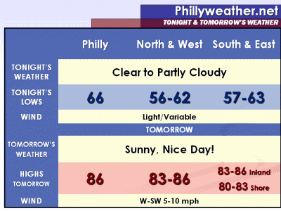
Expect lows tonight in the 50's in the typical cool spots (Millville, Allentown, etc.), with 60's in the built up burbs and city.   Tomorrow's highs range between 80 (Shore) and 86 (Philly), with most everyone in the 83-86 range in the Delaware Valley.   Outside of a few pop up clouds, it should be a very, very nice day!


Weekend Sneak Peek:  The weekend will feature a gradual increase in humidity and temperatures that will notch up a couple of degrees.   It won't be terribly hot or humid but it will be quite "typical" for July outside.  Highs should top out in the upper 80's with mostly sunny skies both Saturday and Sunday.   There is still an outside chance for thunder, especially in Central PA on west, for Sunday but most of us should remain dry through Sunday.   The Shore should top out in the low 80's both days.

Rabu, 13 Juli 2011

July 14th, 2011 Forecast

Today's been rather warm but it's not as bad as the past couple of days as humidity levels have been slapped around a bit.   A secondary push of comfort is nudging south and southeast into the Delaware Valley and will bring a four day stretch of rather nice weather as high pressure sets up along and just off the New England coastline.

Tonight's weather will feature increasingly comfortable conditions with partly cloudy skies.  Low temperatures will drop into the 60's for many, with 50's in the Lehigh Valley later tonight.    Thursday features a ton of sunshine and dew points in the comfortable 50's...perhaps even some upper 40's in the afternoon.   The refreshing comfort will be great of us, the dry weather not so great for plants in some parts of the region that are still quite thirsty.   High temperatures, however, will be nice no matter how you slice it as they should top out in the mid 80's inland and in the upper 70's at the Shore.


The stretch of nice weather should continue through Saturday...perhaps even Sunday.  We have a shower or storm in the forecast for Sunday if return warmth/moisture around high pressure are enough to trigger one or two -- not a certainty by any stretch.   90's loom for next week for at least a couple of days, with Tuesday a potential wildcard as thunderstorms are in the forecast.

Selasa, 12 Juli 2011

Forecast for Wednesday, July 13, 2011


There is a very slight chance of a pop-up thunderstorm between 8 p.m. and 3 a.m. with the passage of a cold front in our region. On Saturday, I mentioned how we would probably be sandwiched in between most of the energy for Tuesday with this front. This looks to remain the case. I’d probably focus in on the eastern half of the region for any sign of a pop-up cell. Temperatures aloft aren’t much different than the surface and thus that is limiting the unstable parcels of air. Westerly winds this afternoon will also put a cap on the convective development through tonight.

For Wednesday, the cold front will be south of the Delmarva region. A wave of low pressure now appears to develop along the boundary. Depending on the exact location of the front as this wave passes by, it may just be close enough to spread a few thunderstorms and showers across Cape May, Dover, and Georgetown. Meanwhile, a secondary cold front is expected to approach the region as well later Wednesday. This too could bring a shower or thunderstorm threat to the remainder of the region, but the greatest moisture plume there is with the front is going to lie in New England. But should there be any interaction with the low passing by on what will be the former front, there could be just enough organized lift to pop a cell. With all of these disturbances expected, I am expecting more in the way of clouds then sunshine.

Behind the secondary front, it looks like several days of sunshine are in store. High pressure will be in control of our weather. Less humid and more seasonable temperatures will overspread the area making for some gorgeous, good weather days. The high will begin to push away from the area on Saturday or Sunday and allow a southerly flow to begin to draw up more heat and moisture by the end of the extended forecast period. It might be possible that showers and thunderstorms ride up on the western edge of the high, impacting Baltimore….Washington….Lancaster…and Reading areas by Saturday. That will be fine-tuned in later forecasts!


As you may know, there were numerous reports of wall clouds & funnel clouds in Winslow and Hammonton Townships on Friday. Two pictures were received as these rotating clouds in this area. Doppler radar indicated a well-defined hook echo. However, the track of the funnel cloud remained over farmland and forests. There were no reports of any damage. Today, I took part in a helicopter mission with to see if there was any damage hidden in the inaccessible by vehicle… woods or farmland. None was seen from the air.

The thunderstorm developed in Salem and Cumberland Counties, around Route 49. In the early development…a possible funnel cloud was reported to have developed just southwest of Route 49 around Shiloh by a few people. A picture did surface of this funnel cloud. Interestingly enough, the velocities on the radar did not show much rotation at the time of the first funnel cloud. The storm then weakened some….but became more indicative of a rotating thunderstorm as it approached Northwestern Atlantic, Eastern Camden, and Southern Burlington Counties.

Senin, 11 Juli 2011

July 12th, 2011 Forecast

Today is hot...tomorrow will be hotter as winds nudge to the west and draw in a downslope effect off of the Appalachians to our west.   High temperatures tomorrow could approach the upper 90's in a few spots, with mid 90's common for just about everyone except the boardwalks at the Shore (where it could hit 90).   With a frontal boundary approaching from the west, pop up afternoon thunderstorms are possible around the region and any of the stronger storms could bring locally heavy downpours and gusty winds.   Combined with dew point values in the upper 60's tomorrow, heat index values in the upper 90's to near 100 loom so exercise caution around town.   Thankfully, tomorrow is the last of the heat for a while as a cool front crosses the region Tuesday night and lower humidity values and typical July temperatures return.

Between now and tomorrow, a chance of some passing scattered thunderstorms tonight is in the forecast as a weak disturbance (that fired off a severe weather event in the Midwest yesterday) crosses the Lakes and fires up more thunderstorm activity to our west later on.   Some of that should get into the region and cross on through later this evening.   It will be a warm, muggy night locally as temperatures drop into the 70's for everyone, perhaps only getting as low as 75 in the city overnight tonight.


We'll update the thunder threat for tonight in a post later this afternoon/evening and provide another update for Tuesday's thunder tomorrow morning.

Minggu, 10 Juli 2011

July 11th, 2011 Forecast

After a nice, but warm weekend we're going to see the ratcheting of humidity again for a couple of days in advance of a cool front that will cross the region on Tuesday afternoon (with thunderstorms).    While tomorrow will be warmer and more humid, the worst of the humidity will come on Tuesday where the heat index will probably feel close to or over 100 degrees.  I would not be surprised if we have a heat advisory or warning out in the region then.

Until then, it's just gonna be warm.   Tonight's lows will range from the mid 60's in the cooler burbs to the lower 70's in the city with light winds.   Tomorrow features a mainly sunny sky with some isolated thunderstorms possible late in the day to our west and northwest (I think Central PA on west).   High temperatures will range from the low/mid 80's at the Shore to 93 inland.  Humidity levels will bring the heat index to as high as 95.


Week Ahead:   Tuesday looks pretty nasty from a heat/humidity standpoint but a cool front should bring relief -- and probably some thunderstorms to the region as well.  This front will push south of the region and will bring lower humidity to the region and temperatures that are "typical" for mid summer.  Expect highs for the rest of the week in the middle 80's with lows in the 60's, plus tolerable humidity levels for Wednesday through Friday.  We could see humidity return somewhat this next weekend, perhaps with some shower chances on Sunday.

Sabtu, 09 Juli 2011

Forecast For Sunday, July 10, 2011


Drier air has been filtering in behind yesterday’s cold front. It was still a bit humid this morning, but the lagging arrival of the drier air combined with afternoon mixing has done a decent job at lowering our regional dew points. The localized sea breeze effect could reverse this for a time along the coastal communities.

Tonight, it will be clear. Some shallow fog could develop with the ground still moist and enough moisture content left in the air, but it will be patchy.

High pressure remains in control for Sunday. The heat remains in place along with the humidity. Highs once again will reach 90 degrees and the urbanized centers could exceed 90 for a time in the afternoon. The shore points and the Pocono Mountains will be cooler by a few degrees.

On Monday, cumulus clouds will bubble up in the afternoon. A weak short-wave passing by to the north of Philadelphia and increasing warm air advection may set the stage for a few isolated, but strong thunderstorms. Otherwise, sunshine will cause temperatures to rise into the lower and mid-nineties.

A strong cold front will approach the region on Tuesday Afternoon and Tuesday Night. It could get quite hot before the frontal passage with highs in the mid-nineties with some upper-nineties possible. Showers and thunderstorms should accompany the front, but they will be scattered in nature. The early read on the modeling is that the most potent energy will be more focused to our north and to our south. But with the hot temperatures expected, instability will be rather potent. So while storms could be scattered…they could quickly turn severe.

On Friday, we did not reach 90 degrees, ending our latest heat-wave. However, we are probably beginning another one as of today since we have already reached 90 degrees at mid-afternoon and expect 90+ temperatures through Tuesday. The past two months have featured very few days of below average temperatures. If we see the next three days top out at 90, then we should end up with 17 days of 90 or better so far this season.

Jumat, 08 Juli 2011

July 9th and 10th, 2011 Forecast

Check out updated radar of this afternoon's and this evening's thunderstorms

Once we get through this afternoon and tonight's thunderstorm activity (you can read about that here) we should see conditions improve in the weather department for the weekend.   Humidity levels will lower a good bit although temperatures will not despite a frontal boundary moving through the region.   It will turn out to be a rather nice July weekend with decent humidity levels, a good deal of sunshine, but it will be warm.   Expect highs on both Saturday and Sunday in the upper 80's to around 90 away from the ocean, with lower 80's at the Shore and Delaware Beaches both days this weekend.

Saturday may feature some cloudiness or patchy fog around town to start but both should exit or dissipate as the morning progresses.   Sunday will be mainly sunny other than some fairweather clouds that pop during the day.

Lows this weekend drop into the 60's in the burbs to around 70 in Philly.


Kamis, 07 Juli 2011

July 8th, 2011 Forecast

The story of the next 24 hours will be the threat of showers and thunderstorms around the region as a weak front stalls over the region, with a weak area of low pressure developing along the front and moving east.   This low will enhance the thunder threat so that more parts of the region will get some rainfall over the next day or so.   However, some spots will go dry while others pick up a couple of inches of rain in localized downpours.

Thunderstorms that are popping up/about to pop up will continue through the evening hours before diminishing some in coverage for a while overnight.   As the weak surface low develops later tonight out in the Ohio Valley, more thunderstorms could break out along the frontal boundary and lift northeast, meaning storms could return for the morning commute.  Essentially an on/off/on type of forecast regarding scattered thunderstorms.   Thunderstorms will continue in scattered fashion on Friday, with some localized downpours possible in spots (best chances appear to be along and just north of the front once it stalls out).   Predicting where the front stalls out is low confidence but based on consensus of the computer guidance the front should fizzle just south/east of Philadelphia but since summertime fronts are weak and quite fickle this is far from a sure bet.   Once the low moves on through Friday night, thunder chances will wane from northwest to southeast.

It won't storm at all times but the threat for thunder is there -- scattered at times tonight but with a noticeable break or breaks, with more numerous (but still scattered) thunderstorms for Friday.   If it isn't storming out, it will be humid.   Lows tonight will generally bottom out in the 68-74 range, with highs on Friday ranging from 80 at the Shore to the mid 80's inland.


Weekend Sneak Peek:  Humidity levels will decrease on Friday night with the front's slow push off the coast. Sunshine will increase on Saturday and the weekend looks quite nice but warm overall.   Expect temperatures in the upper 80's to near 90 both Saturday and Sunday, with low 80's at the Shore.  Lows will be in the 60's to around 70.

Rabu, 06 Juli 2011

July 7th, 2011 Forecast

A weak frontal boundary will move into the region tomorrow and bring a brief respite from the 90 degree run we're currently under.   The pop up thunder threat that will commence shortly this afternoon in spots will continue tomorrow, with thunder a bit more numerous around the region thanks to the presence of the approaching frontal boundary, and also continue on Friday as the front stalls out near the city.   Humidity levels will be on the increase over the next day or so before we get some relief from the muggies for the weekend.

Any thunder that pops up over the next couple of hours will dissipate after sunset, with mostly clear skies overnight and low temperatures in the upper 60's to low/mid 70's across the region.   Highs tomorrow will range from the mid 80's at the Shore to between 88 (northwest) and 94 (Delaware) across inland areas.   Thunderstorm activity will pop after 2 PM, likely in Central Pennsylvania, and work through the afternoon.   Not everyone gets thundered on tomorrow but there will be some locally stronger storms in spots (gusty winds, locally heavy rainfall, typical summer thunderstorm activity).


We'll provide an update on Thursday's thunder threat tomorrow morning.

Selasa, 05 Juli 2011

July 6th, 2011 Forecast

We are currently in the middle of heat wave # 3 of this summer 2011 season. July 3rd reached 90 degrees, July 4th reached 90 degrees, and as of 4 PM today's high so far was 91 degrees. There should be another 2 days of 90 + degree weather, making this a 5 day heat wave. Dew points have been modest up through today, but it will begin to feel more humid overnight tonight, and the humidity will stick around for the next 3 days.

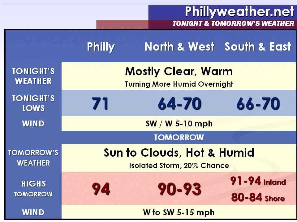
Tonight: Mostly clear and warm, turning more humid overnight as dew points rise into the lower to mid-60s. Lows will drop between 64 and 71 degrees. Southwest winds this evening will shift from the west at 5 to 10 mph. The sunset tonight is at 8:33 PM.

Wednesday: Bright sun to start, then clouds increase in the afternoon. There is a 20 percent chance of an isolated thunderstorm during the afternoon or evening. It will be hotter and much more humid than today with a high near 94 degrees. West winds in the morning will shift from the southwest at 5 to 15 mph.

Thursday: Hazy, hot, and humid with pop-up thunderstorms in the afternoon. The high will be around 91 degrees. The chance of rain is about 40 percent.

Friday: Hazy sun and humid with more thunderstorms possible. The high will be around 87 degrees. The chance of rain is about 40 percent.

Wednesday Planner

7 AM 74 degrees, Bright Sun

Noon 89 degrees, Hazy Sun

5 PM High near 94 degrees, Isolated Storm

Sunrise 5:39 AM
Sunset 8:32 PM

Senin, 04 Juli 2011

July 5th, 2011 Forecast


The warmth of July continues this week as a weak front fizzles out clearing the coastline this evening.  Warmth remains in place while humidity levels reduce for a day, which means Tuesday will be quite warm but not that terribly humid as high temperatures approach 90 degrees in many locations away from the coast.   We'll transition to the lowering humidity locally with a few stray evening thunderstorms, generally to the south and southeast of town, before they dissipate after sunset.   Skies overnight tonight will remain mostly clear and temperatures will drop into the lower 60's north and to the lower 70's in the city itself.

The lower humidity won't last as more moisture returns on Wednesday in advance of another weak frontal boundary.   Expect dew points to start climbing Wednesday afternoon and a chance of a stray thunderstorm can't be ruled out, especially south of town.   The theme for much of the week will be temperatures that will top out at or near 90 degrees on a daily basis through Thursday before we nudge back into the mid and upper 80's for next weekend.

Minggu, 03 Juli 2011

4th of July 2011 Forecast


We've dodged the heat bullet a bit this weekend...not that yesterday wasn't warm (89 is warm) but humidity was tolerable yesterday.   While today's humidity is higher temperatures probably don't cross that 90 degree mark this afternoon thanks to the presence of showers and storms this morning and more expected this afternoon/evening.  (Update, 5 PM, the official high at 5 PM was 90 degrees...just enough sun for the 90 degree mark to finally win out)   However, with the weak front responsible for today's thunder fizzling as it crosses the region we'll see temperatures finally cross the 90 degree mark...and probably hang out at or just above 90 for several days this week.   I talked about the potential of a cheap (90 degrees but not much higher) heat wave...it may be 'delayed but not denied' as things look pretty warm this week.

Any scattered thunderstorm threat that does materialize over the next couple of hours will move east and then fizzle after sunset, leaving a partly cloudy sky locally.   Temperatures tonight will drop into the 60's north/west,  low 70's in Philadelphia and around 70 south and east of town.   Humidity levels will be pretty high most of the night, especially in Philly and south/east as the weak front doesn't move through until later.

The 4th looks very warm -- highs around or just above 90 away from the Shore with a healthy dose of sunshine.   Humidity levels come down a bit but it will be a warm one locally.   The fizzled front could provide enough of a spark to trigger an isolated thunderstorm in the afternoon but odds are leaning against much, if any activity.   The Shore should hit the mid 80's as the sea breeze doesn't kick in until the afternoon.


Week Ahead:    The next substantive thunderstorm threat looks to be Thursday as another weak cool front tries to make inroads across the region.   The front lingers into Friday and, like this current front, could fizzle out just offshore.   Temperatures could reach or surpass 90 through Thursday before getting knocked back into the mid and upper 80's for the end of the week.   Humidity levels will nudge higher on Wednesday in advance of the Thursday/Friday thunder threat, making for a humid Thursday in the Delaware Valley.