Tampilkan postingan dengan label computer model discussion. Tampilkan semua postingan

Kamis, 30 Juni 2011

Sunday Thunder Threat

The heat will gradually be on this weekend, with 90 degree weather hitting the region on Saturday and perhaps lingering for as many as five days into the middle of next week.   Sunday originally looked like the hottest day of the stretch, with an outside chance of 95 degrees as soon as yesterday's computer guidance, in advance of a cool front that is poised to slide on through the region with a thunder threat.   The timing of the front looked originally to be late afternoon and early evening with thunderstorms popping up along and with the weak frontal boundary. Some hints are showing up that the timing could end up being a bit earlier on Sunday.


Most computer guidance from this afternoon is suggesting either a midday or afternoon thunder threat...some of which could be severe. It doesn't look like an all day event and thunderstorms could fire on a line (frontal boundary) and slide southeast.  Whether the storms fire at 12, 2, or 5 is always an exercise in "to be determinedness" but the odds of some thunder on Sunday are pretty good.

Regarding the weekend as a whole, it will be very warm as temperatures will be in the 90 degree range or the low 90's for the weekend.   Not the hottest on record (no 100 degree weather in sight) but it's still a "typical" summertime weekend around the Delaware Valley, with Sunday the one day with a thunder threat.

Selasa, 14 Juni 2011

End of Week Rumbles


After tomorrow's mostly sunny day and relatively nice temperatures, we go back downhill as we work through Thursday afternoon and Friday.   A storm system currently over the Midwest will work east and spread showers and storms into our region during the afternoon from southwest to northeast on Thursday afternoon.   While the day may start sunny clouds will be on the increase, with showers and some rumbles of thunder moving in during the afternoon hours.  The GFS (above) shows precipitation moving in on Thursday and over the region for the evening rush.

This system is a slow-mover -- it will lurk over the region for Thursday PM, Friday, and early Saturday before finally fizzling as it pulls off the coast.   While it will not rain the entire time over that 48 hour stretch, there will be rounds of showers and scattered storms around the area, more numerous with Thursday afternoon's entrance of precipitation into the region and again on Friday afternoon with the influence of daytime heating on the atmosphere.   Some precipitation may linger into early Saturday but computer guidance is split on whether any showers pop up or linger around, between the Euro clearing us out and giving us a pretty nice day and the GFS saying "not so fast" to a full drying trend with its chance of some showers nearby.

This upcoming system does not look like a tropical soaker of epic proportions but it does provide the region some needed rainfall -- we could see some one inch totals between the two days in some spots from heaiver shower activity, especially across higher terrain to the north.   Locally, half inch totals look doable at this point.   Given our general dry trend the past seven weeks, save for a couple of events, this type of rainfall will be appreciated by local gardens and gardeners.

Rabu, 08 Juni 2011

Strong Storms For Some Tomorrow Evening?

Our heat event is potent but not long lasting as relief will start to slide towards us in the form of a cool front tomorrow. This front will be a bit of a factor in the forecast over the weekend as it stalls out in the region and enhances the thunderstorm potential for Friday and Saturday before a second front comes in from the west and clears the coast late Sunday. As is the case with many summertime fronts the push of cool air is not impressive behind it but relief is relief even if the front stalls and brings thunder chances.

Since this front will cut into a hot and humid airmass the potential for thunderstorms exists tomorrow afternoon and evening. The best chances for storms to develop will be to our north and northwest and some of those storms could be strong if not severe. There is a slight risk of severe weather out for areas north of I-78 tomorrow, with the best chances of severe weather across Northern and Western Pennsylvania.


The timing may not necessarily be optimal for us to get severe weather locally as computer modeling suggests that most of the activity holds off from moving into Philadelphia until after 8 or 9 PM.   The NAM computer model depiction up above is for 5 PM tomorrow from a forecast run from earlier today, showing thunderstorms generally are in greater quantity north and west of I-78 late tomorrow afternoon.    Those storms will gradually slide into the Philadelphia region, perhaps not as strong as they will be over the Lehigh Valley or Poconos, but still enough to bring a taste of relief to the region after a flirtation with 100 degrees tomorrow afternoon.

Senin, 06 Juni 2011

Second Heat Event Of Summer Looms

We're a couple of days away from the beginning of our second heat event of the year. Whether it makes it to a heat wave by hitting on 90 remains to be seen but we will get two hot to very hot days, perhaps three, this week before we enter a more unsettled pattern for the weekend as a front stalls out nearby.   The combination of surface high pressure off of the Carolinas and very warm temperatures aloft will allow the heat that brought 100 degree temperatures to Texas and Louisiana the past couple of days to work its way northeast and torch us.

Computer modeling suggests Thursday is the hottest of the upcoming stretch as high temperatures could approach record levels in Philadelphia.   The record for Thursday is 98 and we're predicting 96 in our forecast for Thursday.  Whether it hits or not is not important...the combination of heat and dewpoints in the 60's will bring heat index values close to 100 to the region, which is rather nasty regardless of whether the surface temperature is 95, 96, or 98 as it's gonna be hot.   Heat will even impact the Shore pre sea breeze in the afternoon as the surface winds will generally be west and west-southwest.  Expect highs in the 80's Wednesday-Friday at the Shore Points each day, with temperatures quickly reaching 90 as you get a mile or two inland.


A cool front will try to slide through the region -- whether that occurs early in the day Friday or on Friday afternoon remains to be seen but the front's bigger story is its predicted stalling out over the Mid Atlantic.  Assuming the front does stall out, an unsettled weekend with scattered thunderstorms looms for both Saturday and Sunday.   The one thing the front should be able to do is bring an end to the heat.   Unfortunately, the potential price to pay is a less than stellar weekend but after reaching the 90's for two to three days, some may be willing to pay that price.   Thunder will not occur all weekend long but neither day looks completely dry and thunderstorms will be scattered about more numerous in the afternoon both days this coming weekend.

Jumat, 03 Juni 2011

Sunday's Scattering of Storms

With a weak disturbance working east and then southeast through the Mid Atlantic we will have a chance for some showers and thunderstorms later on Saturday night, continuing into Sunday around town.   The disturbance is not very strong and dynamics with it are not that impressive but any time there is a disturbance around in summer thunderstorm chances exist.  


If the NAM is to be believed on precipitation, the best chances of thunderstorms will be on Sunday across the western and southern parts of the region.   The GFS is a bit faster, with the lion's share of scattered storms on  Saturday night, again with the best chances to the west through south of Philadelphia as these storms (or showers) scoot along to the southeast.   The GFS suggests some pop up shower/storm activity on Sunday but it's widely scattered, if not isolated in nature.

Sunday shouldn't be a washout but it's possible, especially west or south, some spots get some thunderstorms from this weak disturbance as it moves through.

Rabu, 25 Mei 2011

Memorial Day Warmth Forthcoming

It's going to be a summery Memorial Day weekend, very similar in many respects to last year's weekend when we saw our first 90 degree day of many in 2010.   A summery pattern is generally kicking in starting tomorrow, which offers the outside chance of a 90 degree day in Philadelphia as southerly winds nudge northward and we stay on the warm side of a frontal boundary.   That front fizzles upon crossing the region on Friday night and Saturday, leaving a lingering boundary around on Saturday that could spark a thunderstorm.

The boundary essentially falls apart due to a strengthening upper level ridge of high pressure in the South, which will flex its heat muscle and push warmth up the East Coast.  The ridge weakens slightly on Friday and allows the surface front to push through and brings us scattered thunder chances in the afternoon, with only an outside chance for thunder on Saturday afternoon as the boundary fizzles away.

We could see a thunderstorm any afternoon over Memorial Day weekend but temperatures will be warm -- mid 80's on Saturday and Sunday afternoon, low 90's on Monday as the ridge strengthens further and high pressure entrenches at the surface off the Carolina coastline -- providing an optimal path for heat and humidity.   The Shore will be cooler but still summery -- 70's for highs each afternoon east of the Parkway, 80's west of it.   There could be a seabreeze that pushes further inland each afternoon but by and large it should be a nice weekend.   Again, each afternoon or evening could present an outside chance for thunder but much of the holiday weekend will be awesome.

Selasa, 17 Mei 2011

Showery, Unsettled, But So Far Dodging The Worst

An upper level-driven disturbance tends to throw curveballs at opposing forecasters, leading to moments of hair pulling, premature balding, and in my case just deciding to use a razor and lop it off.   Today hasn't been the best of days but it could have been much worse.  Computer guidance was leading us down a rainy path with periods of showers and thundershowers that could drop heavy rains.  We've had a few of those periods of showers move through but have been able to dodge the worst that Mother Nature could throw at us.

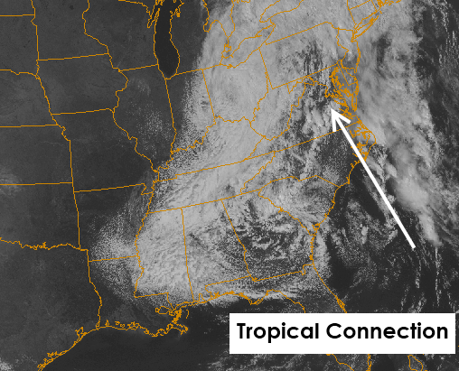
Based on my observations, while the moisture fetch with this system is impressive, we've been lucky to see most of the moisture so far get thrown north into Southern New England and into the New York Metro areas.   The flow at the mid levels of the atmosphere is rather robust from the south and is driving moisture farther north and less northwest than modeling and forecasters had predicted.   Most guidance was pivoting rainfall around the low but we're seeing that happen only in areas close to the upper low center.  There's a bit of divergence between the broader southerly mid level flow and the mid level center.   The southerly mid level flow that coincides with where the best lift and dynamics (east of us in the Atlantic) is helping drive rain up the coast, just offshore, and into Long Island and Connecticut.    Good for those of us who don't want rain...bad for forecasters who predicted it since this afternoon hasn't been an utter washout.   It's certainly not a nice afternoon but it could have been a lot wetter.   We should see the upper low pivot a bit more west and that should allow that divergence to lessen...might not be until later tonight though.

The trend between now and Wednesday night is periods of showers and thundershowers.   The problem is timing...details...and how much.   The potential still exists for one to three inches of rain -- not everyone will see three but most should see one by the time tomorrow night ends.   The higher res depiction of what will happen between now and tomorrow afternoon shows two main trends (scroll down for those trends):


1) There will be lulls -- one that lingers now through the evening before we start back up later tonight, with another lull possible tomorrow during the mid to late afternoon (less certain).   Rainfall will not occur at all times but the potential for rain is around at most times...although the rainfall chances will be much lower in the lulls.

2) Any showers still have the potential to be locally heavy (evidence the showers/storms in Maryland this afternoon) and could lead to localized flooding.  Keep in mind these will be localized in nature and not definite...just a possibility.

We'll provide another update in the morning.

Senin, 16 Mei 2011

Flood Watches & Banding Of Rainfall


Today's weather, while unsettled, will seem rather nice in comparison to what we have coming at us for Tuesday and Wednesday.   The potential for heavy rainfall in the region on Tuesday and Wednesday from an upper level low tapping into tropical moisture (see the satellite picture below) has lead to flood watches getting issued for the I-95 corridor for the next couple of days.

The satellite image shows an upper level low over the Southeastern US and a broad southerly flow setting up along the East Coast.   A bit of a backdoor front has drifted south across the region today and will act as a rainfall enhancer over the coming two days as the southerly flow of moisture lifts across this boundary as well as the higher terrain to the north and west of Philadelphia.   This will result in periods of showers and storms, some of which will be heavy at times, as the flow around the upper low pushes rainfall north, then northwest around its circulation.

Rainfall will be heavy at times and in spots over the coming two days, with some potentially significant rains in some spots by the time we get out of Wednesday.  Some spots could pick up over three inches of rain, with many of us getting over an inch over the next two days.   Due to the showery nature and banding nature of the rainfall, predicting the heaviest amounts is low confidence but there will be two periods when our region could see heavier rainfall.  One is from Tuesday morning, with a second heavier period possible on Wednesday afternoon.  Showers/storms in between could be locally heavy but guidance seems to suggest the heaviest and most widespread rainfall in Philadelphia will be in those two time frames.   The heaviest totals overall are focusing on New York City according to the NAM, with four inches possible if the midday guidance is right.


The Euro is a bit less aggressive on heavy rainfall, with two inches of rain across areas north and west of Philadelphia.   The GFS has an area of heavy rainfall west of Philadelphia (three inches plus) and up near New York City (three inches there as well).   Needless to say, figuring out the "exact" location of heavy rain is not a perfect science but if you are north and northwest of Philly, the odds are pretty good that a couple of inches or more of rain will fall by Thursday morning.

We'll have another update in the morning.

Kamis, 12 Mei 2011

Unsettled Weekend

All good things must come to an end -- and this weather pattern is no exception to that. A weakening upper low in the Western Atlantic will cause high pressure ridging in the Southeast to weaken, which in turn allows a disturbance in the Midwest to come east and visit us for the next several days.   Friday is the last "good" weather day of the next several as we will be dodging drops from Saturday through Wednesday at various times, with some intervals of time featuring more drop dodging than others.

Shower activity starts around here on Saturday as the first wave of this disturbance approaches the region.  Scattered showers move in from the southwest and west, especially in the afternoon and continuing through Saturday evening and into Sunday.   The first half of Saturday could be misty or foggy in some spots but most locations should remain shower free until the Noon hour.

By Sunday, low pressure will be broadly centered over the Appalachians and stuck from advancing eastward thanks to the weakening upper level storm in the Atlantic and also a larger center of high pressure that is in the Central Atlantic.   This results in a stalled out situation where the upper level system will generate weak disturbances that will throw shower chances into the region through the middle of next week.  It won't be a washout throughout the period -- Monday may turn out to be a halfway decent day -- but with low pressure in the vicinity and nothing to kick it out of the way the pattern remains largely 'stuck' and this upper level low and broad surface low will be in no hurry to move out of here.

With the first wave of this upcoming pattern entrenched in the region on Sunday, shower chances will be widespread and some thunderstorms can't be ruled out either.   There could be some heavier rains but determining who gets what and how much falls is low confidence at this point since computer modeling is not consistent on where the heavier precipitation gets dropped.   There is confidence, however, that most of the region gets some rain on Sunday.


In terms of getting stuff done outdoors, Saturday morning might be the best bet for relatively dry weather...the later in the weekend one gets the greater the chances for some rain to fall.

Selasa, 10 Mei 2011

Uncertainty For The Weekend...Except A Chance of Rain

Arguably the best stretch of weather we've had this year so far has given us consistent temperatures in the 70's day after day since Friday...and you can thank the blocking pattern in the Atlantic that has been giving us this wonderful run of weather that will continue through the end of the work week. The bad news is that the weekend will not be as nice as we have thunder chances returning on Saturday as an upper level storm system and surface low meander through the Southeast, coupled as well with a frontal boundary drifting south from Canada.

There are questions over how widespread thunderstorm activity will be -- the Euro computer model is painting thunder chances for both Saturday and Sunday, with Sunday's chances more widespread for the region although scattered storms could be the rule both days this weekend.   The GFS is less robust in thunder chances -- that could be due to the placement of the upper level low over the Great Lakes on the GFS and the frontal boundary from Canada being much slower in its approach than on the Euro.   If the GFS is correct, it would yield more isolated thunderstorms and showers around town and less widespread activity.


The other thing we will have to watch this weekend is winds coming in off of the Atlantic ahead of the low.  If the Euro is right, winds could be more east than south, which is what the GFS is suggesting.  That could yield forecasting havoc on temperatures for the weekend as the Euro's solution suggests 60's while the GFS is saying 70's in today's run for the coming weekend.    Like we said a few days ago, hope you enjoy the coming days of weather!

Sabtu, 07 Mei 2011

A Few Showers, Mostly North, Later Today

We're waking up to dry skies and a good amount of sunshine around the region this morning, setting ourselves up for a mostly nice day.   An upper level disturbance is scooting by to our north and has showers across New York State, trailing back into Northwest Pennsylvania and Eastern Ohio this morning.  Those showers off to our west will track through Pennsylvania through the day today and we'll see some shower and thunderstorm activity move as well as pop up in spots through the afternoon as the atmosphere gets agitated from the disturbance's nearby presence.   This doesn't mean that the afternoon will be a wash out but we could see a few showers or storms around town, especially after 2 PM.


The NAM depicts the highest coverage areas as being north and west of the city but even that coverage is pretty scattered and light.  This isn't a big deal kinda system but like any scattering of showers and storms, a 20-30 minute detour of outdoor activities to the house, car, or appropriate sheltered location may be in the offing for a few folks later on.  A couple of showers can't be ruled out south and east of town but the odds there for any rain are a good bit lower than they are to the north and west.

Temperatures today should top out in the 70's away from the coast, with 60's at the Shore.

Rabu, 04 Mei 2011

Friday Shower Chances

We'll quickly exit this chilly hit of temperatures and return to a more typical May temperature (lower 70's) as soon as Friday. With that moderation in temperature expected over the coming days, an upper level disturbance will spiral through the Mid Atlantic and act as a trigger for some showers during the afternoon and evening hours, primarily to the west of Philadelphia on Friday afternoon and then across the region on Friday evening...at least as computer guidance is indicating as of now.


This doesn't look like a washout or an all-day event by any stretch -- and much of Friday should be dry although clouds will increase as the day wares on and the upper low moves in.    Scattered showers are certainly possible, however, and a few rumbles of thunder can't be ruled out as well in the strongest of showers.   These weak upper level disturbances will be the norm over the coming days as a zonal pattern develops in the East and we see quick moving systems work through along the mean jet stream.   It wouldn't surprise me to see us get shower chances every other day through the next week.   No washouts but no prolonged dry weather, either!

Senin, 02 Mei 2011

Like A Traffic Jam On The Schuylkill...

...so goes the latest cold front to approach the region. Yeah, another one of these slow-to-approach and slow-to-cross cold fronts is inching towards Philadelphia and will have us in the warm sector until the wee hours of Wednesday morning.   The slow march, then stall, and then a final move of the front as it waits for low pressure to develop and lift northeast along the front means we'll coax one warm day out of the coming week, with temperatures hitting or exceeding 80 in Philly tomorrow afternoon.   All the while, a chance for showers and storms will exist across Western and Central Pennsylvania tonight, with Western Pennsylvania seeing more thunderstorm activity develop tomorrow afternoon as the low lifts north and agitates the front.

Until Tuesday night, Southeastern Pennsylvania is poised to remain dry -- although a shower or two can't be ruled out as close as the northern and western burbs as an area of showers moves through this evening.   The NAM, GFS, and most computer guidance keep the showers away from Philadelphia until Tuesday night.


The front will gradually approach on Tuesday evening, working east as low pressure rides along the front to the northeast.   Showers and thunderstorms develop along the front and lift northeast as the front marches east, with the potential for some severe thunderstorms in parts of Central Pennsylvania tomorrow afternoon, possibly into Eastern Pennsylvania tomorrow night depending on how the front moves.  The northern and western suburbs, along with Central Pennsylvania, are under a slight risk for severe weather for Tuesday and Tuesday night.  Gusty winds and heavy rains are possible with any thunderstorms that develop.   The threat for flooding around here is low but some stream rises can't be ruled out if heavier thunderstorms track into the region.


Most of the activity is poised to move through the region Tuesday night and midday Wednesday, first as possible thunderstorms across Central into Eastern PA, secondly followed by an area of steadier showers or rain that may lift through the region during the morning hours.

Senin, 25 April 2011

Ending Early Summer

After a multi-day run of 80+ degree weather around these parts, all good things must come to an end for a time. A stronger cold front will finally move into the region on Thursday after weaker boundaries failed to push into the Bermuda High in the Atlantic. This stronger storm system will not only end the 80 degree warmth but also bring a potentially nasty round of thunderstorms to the region -- if the timing is right.


Computer modeling consensus suggests the front passes through the region around midday Thursday -- the Euro and NAM computer models are latest and suggest a Thursday PM timeframe (more optimal for bad storms) while the GFS suggests a morning timeframe.   Storms that develop could bring strong gusty winds but given the setup of the storm system (shifting winds aloft) some tornadoes can't be ruled out.   Plenty can change given we're three days out but the setup, on paper, looks good for at least some severe weather around the region on Thursday.   We'll update the potential as we get closer but it looks like summer's first foray in the region could end with a few pops and bangs.

Before that, however, there is a chance for some thunderstorms on Wednesday as the humid airmass that's moving north could pull some tropical moisture into the region from a disturbance that's down in the Bahamas at present.   The tropical disturbance won't become a tropical storm or anything of the sort but it could enhance some thunderstorms in parts of the region on Wednesday afternoon.

Jumat, 22 April 2011

Could Easter Feature 80 Degree Warmth?

The approaching warm front that will lift northward tonight and tomorrow will bring warmth to the region. Depending on how much sun we see on Easter Sunday, prospects are increasing that parts of the region might see 80 degree temperatures. While we did not forecast it in our earlier forecasts, trends throughout today on the NAM and in other computer models do show the potential that temperatures on Easter could be more like Memorial Day...if everything breaks right.


Sunshine may be a premium on Easter but if some sunshine does break out the NAM is showing some low 80's in parts of South Jersey and Delaware, with mid to perhaps upper 70's in Philadelphia.   The GFS was suggesting low 80's in one computer model run, mid 70's in another throughout the day.   The lack of consistency in this makes any forecast for Sunday less-than-ideal confidence -- the position of the front, how much precipitation, and cloud cover will all play a factor in Sunday.

Speaking of precipitation, there is a chance for some thunder on Sunday afternoon into evening.  Computer models show a wave of low pressure working east along the frontal boundary and enhancing some precipitation chances across the region for Sunday afternoon.   One can't rule out the potential for some thunderstorms in the afternoon as well.   Unlike tonight's and early Saturday's rain, this does not look like a widespread event for the region.

After tonight and early tomorrow's chilled showers, get ready for some warmth....while the frontal boundary hangs out around town.

Rabu, 20 April 2011

Another Weekend, Another Chance of Rain

Going back to April Fools' Day we've had rain on Friday or Saturday for each of the last three weekends -- that trend extends to four this weekend as we get another storm system organizing across the Plains and moving in to the Great Lakes and Northeast.   Moisture streams out ahead of the storm center on Friday, bringing a chance of rain to the Philadelphia region perhaps as early as Friday afternoon but definitely for Friday evening and Saturday.   Rainfall from this next storm system should not be as heavy as last weekend's precipitation but some places, especially north of the city, could pick up an inch of rain from Friday night into Saturday with the storm system.  At this point widespread flooding does not look likely but it will reinforce a soggy ground that dominates to our north.   The GFS (below) shows the first fingers of the storm system moving in on Friday afternoon, with the best chances of showers generally in the city and points south through west of town.


In fact the next several days after tomorrow look unsettled as the storm system responsible for this round of rain moves through but the frontal boundary associated with it does not immediately clear through.    This would result in shower and thunderstorm chances continuing on Sunday, perhaps into Monday, before there's enough push north of the frontal boundary to give the region a couple of days of warmth.

Friday looks rather chilly to boot as clouds move in and winds off of the Atlantic result in a cool day with high temperatures in the lower 50's.   The slow painful march towards consistent warmth continues...

Selasa, 19 April 2011

Slight Risk For Severe Tomorrow

You would think that today's chill and showers would lead to more chill and showers. For once, that's not the case. The stalled front is due to lift northward tomorrow and we should get into a several hour period of warmth during the midday and afternoon hours.    Low pressure (which helps nudge the front north) will track east through the Great Lakes and along the NY/PA border tomorrow afternoon, dragging a cold front back through the region late tomorrow evening.   This front will get agitated by the warm, unstable airmass between the warm front and cold front and the potential for severe weather exists in the region tomorrow afternoon and evening.   The Storm Prediction Center has us in a slight risk for severe weather tomorrow, with a heightened risk for severe weather across the Delaware Valley down into Washington, DC.  


Timing is everything, however, with the storms firing up and are dependent on sunshine plus warm sector influence.    With that said, there's a good bit of pop in the atmosphere int he warm sector so there should be some activity for at least some folks.   The thinking is the warm front should get north of the Lehigh Valley by midday and allow for enough warming for everyone to allow for thunder chances late in the afternoon.  The NAM and higher res modeling suggests that this takes place between 4 and 7 PM in Philadelphia.   The GFS and Euro are less enthusiastic on severe but highlight the potential for some showers and storms around the area.


Winds could gust to 50+ mph with the line of thunder as it forms.  Hail does not seem likely at this point but any storms that do pop could not only drop strong winds but also heavy rain as they move east.   Some poor drainage area flooding can't be ruled out tomorrow afternoon in some of the heaviest storms.

Senin, 18 April 2011

Tomorrow's Rain & Thunder Chances

The waffles of a springtime frontal boundary mean larger changes in temperatures over a short distance. In the case of our current weather pattern, a stalled out frontal boundary will lie just to Philadelphia's south tomorrow before nudging back northward tomorrow night and into Wednesday. While the front meanders around the region, various weak systems will traverse east along the front and provide shower chances for the region.   The first of these is tracking through and north of the Philly area tonight with showers -- the best chances of these will last through the evening hours before the system pulls away and drags the front down to about Wilmington.

Round #2 comes east tomorrow with rain and some embedded thunder from about midday into the afternoon hours.  The NAM (below) shows the potential for the heavier showers and thundershowers generally just north of Philadelphia, an idea that is backed up by the GFS (although the GFS is farther north with the showers than the NAM as it places the frontal boundary near and just north of Philly).   The NAM probably has a slightly better handle on the frontal boundary spot but where the front lines up is critical for where temperatures ends up on Tuesday -- it could be 70+ in Dover while in the 50's in Allentown tomorrow afternoon.     Showers will also track along and just north of the front, meaning the best chances for rain tomorrow will be Philly and north.


Rainfall should total a quarter to half inch north of Philadelphia, with some isolated higher totals in Central and Northeastern Pennsylvania that could reach three-quarters of an inch.   The front will nudge northward on Tuesday night and Wednesday, providing a chance for the region to surge back towards 80 on Wednesday...at least for those who get south of the front!

Rabu, 13 April 2011

Rainy Saturday In The Cards

As we talked about earlier, a couple of nice days are in the forecast tomorrow and Friday, with tomorrow arguably the nicer of the two days.   High pressure builds to our north on Friday and will help develop an onshore flow on Friday afternoon, meaning that cooler air off of the Atlantic will nudge in for the Shore Points and for South Jersey although it will still be a pretty decent day overall.

Saturday, however, will not be a decent day.  A storm system will organize in the Plains over the next couple of days and slowly lift northeast into the Great Lakes.  That system will drag a cold front south through the US and will spread rain on into the region for Saturday.   A wave of low pressure may organize on the front and, combined with that onshore flow from the high to our northeast, will help develop some significant rain and thunder for the region for Saturday afternoon and evening.

Computer guidance between the GFS and Euro has been showing the threat for heavy rain lifting northeast from the Appalachians through Pennsylvania on Saturday afternoon and evening, spreading over an inch of rain through the region, perhaps two inches of rain where the axis of heaviest rain tracks along the wave of low pressure within the surface front (depicted by the blue shade on the GFS above).  In addition to the rain, gusty winds from the east and southeast will add insult to injury.  Wind gusts on Saturday afternoon and evening could gust to over 40 mph, especially at the coast.

This system will pull out of here early Sunday morning, with sunshine returning in the afternoon and providing us a nice ending to a weekend that starts out rather wet.

Kamis, 07 April 2011

Showers, Mainly South?

Showers may spread in late tonight, especially south of the city, but periods of rain are more likely on Friday from Philadelphia on south as a disturbance tracks east along a stalled frontal boundary that lies to our south. The challenge for forecasters and computer modeling is determining how far north that rain shield gets -- the NAM, for example, essentially shuts the rain shield off at Philadelphia and along 422 to the northwest, with increasing totals of rain to the city's south.  Some parts of the Delmarva may pick up over a half inch from this event -- it's just a question of how far north the northern extent gets.   The NAM is the most south of that extent, with the GFS and EURO painting rain farther to the north...perhaps even into the Poconos.

The high resolution modeling from the Storm Prediction Center shows the potential for some rain on Friday evening across Pennsylvania.   During Friday, most of the rain stays south of the city across Delaware but by dinner time the chances for some precipitation near Philadelphia increases.  It is in the "southern" camp to an extent but does suggest that the northern blob of rain in Pennsylvania could track through Friday evening and overnight.


Regardless, the best chances for the most rain are south of the city, with areas north of Philadelphia on the fence to get little more than just showers.  In fact, it could be dry if the NAM is right outright.

We'll update the weather outlook in the morning.