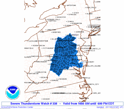
Update, 6 PM: Storms are generally along and just east of the Susquehanna River, with a couple of pop up cells near Reading and near Chester respectively. The main line extends from just west of Lancaster to Bloomsburg in North Central Pennsylvania. All of that is moving east and northeast and is probably a couple of hours away from Philly and should cross the city by 9 PM (or so). The Severe Thunderstorm Watch in Central PA was extended a couple of hours, now out until 8 PM for the counties in Central Pennsylvania. Winds could gust to 45 mph with the storms and some vivid lightning can't be ruled out as well.
Update, 4:50 PM: SPC will be coordinating a new watch box along and east of thunderstorms between 5 p.m. and 6 p.m.
Update, 4:30 PM: Storms are starting to pop up across the region, with a tornado warning up between Harrisburg and State College for a storm that will track a good ways north of us. Closer to us, showers and storms are popping up near Lancaster and north of Baltimore, lifting northeast. This activity, plus the storms out west of York and in Northern Maryland, will be the activity to track over the coming hours as it moves east. The best odds of severe thunderstorms will generally reside along and west of I-95.

If you look at the temperature profile on the map above you can see that there is still some residual cool air lingering to the north and east of Philadelphia, with temperatures in the 60's across Bucks and into North Jersey. Severe chances will drop off quickly as the storms reach and breech the Delaware River later this evening thanks to the stable air in place. That doesn't mean a severe storm can't occur but the odds there are a good bit lower than they are in Chester, Lancaster, or in Berks Counties where the sun has been out a bit more this afternoon.

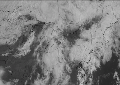
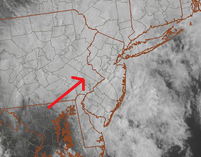
Across the region this morning, clouds have been hanging tight. On the latest satellite imagery, we are starting to note clearing in the southwestern portions of our region, moving up from Baltimore and Washington D.C. This area of sunnier breaks will continue to push northeast with the warm frontal passage into the early afternoon hours. I think the breaks will at least make it through Philadelphia and South-Central New Jersey.


The Storm Prediction Center this morning increased the percentage that severe thunderstorms would occur within 25 miles of a point in the western portions of our forecast area. 30% probabilities have been given to the western sections of our area. Due to the satellite depictions of where the breaks are beginning to occur, this seems to be very reasonable as these areas will be into the sunshine for the longest duration prior to convective development. With the clearing skies expected to make relatively good progress through the remainder of our area, the 15% probability for severe weather or the percentage that warrants a slight risk designation has been moved to include the rest of us not in the 30%.

Basically, this is how it works. 2% for tornadoes or 5% for damaging winds/large hail warrants a “see text”. A 15% or 30% for large hail/damaging winds or 5% or 10% for tornadoes warrants a “slight risk” designation for severe thunderstorms. A 45% for large hail/damaging winds or 15% for tornadoes warrants a moderate risk for severe thunderstorms.
With the warm front rising just above our region and the potential sunshine moving our way, we are in a very favorable quadrant for severe thunderstorms. Most times warm fronts do not have enough energy to produce much more than isolated convection to the south of the boundary. However, this is one of those scenarios where a wave of energy will ride along the front to cause the activity to be more widespread than usual. A similar situation developed last year when a warm front made it up to Southern New York and a severe threat developed (including tornadoes) in Northeast Pennsylvania and Northern New Jersey after sunshine developed. This is the concern I have for today. No doubt that this event will be driven by destructive sunshine.
Tidak ada komentar:
Posting Komentar