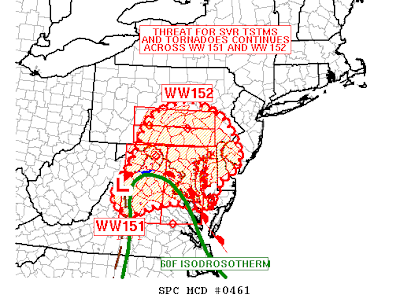
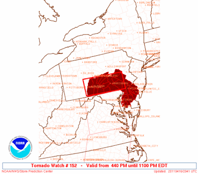
Numerous flood warnings issued...more details shortly...watching tornadic cell approachingYorkCounty .......update at 825....The tornado watch continues (6:45 p.m. update)

In a nut shell, the latest analysis shows an area of low pressure over Virginia with the pre-frontal convection moving northeast ahead of the cold front. While current thunderstorms are reinforcing the cold air at the moment, strong ascent and combined pressure falls will allow the low to eject towards our region overturning the atmosphere to some degree and adding additional instability. Moisture trajectories will increase in response allowing for the deep-layer shear to increase further which will result in better updraft potential. Damaging winds will remain the primary threat, but the isolated tornado threat remains very possible with the low-level shear in place and only increasing for the next several hours.

Thunderstorm Wind Gusts to 70 MPH, Isolated Tornadoes, and Hail to 0.50” in diameter are possible in the watch area.
A tornado watch means conditions are favorable for the development of tornadoes, damaging winds, and or large hail.
Strong pressure falls are becoming clearly visible over Eastern Pennsylvania and Western New Jersey. I wouldn’t be surprised to see this shift northeastward throughout the evening. Without sunshine today, instability is modest at best. However, the jet setting up over the region and heavy thunderstorms will move in from the west and drag the strong winds to the surface with an increased risk for damaging wind gusts. In addition, vertical shear is quite impressive and the strongest thunderstorms may cause some spin-ups which may result in isolated tornado development in our region. Numerous severe thunderstorm warnings and tornado warnings have occurred to our south and west.
Tidak ada komentar:
Posting Komentar