Some pretty big model fluctuations and differences continue in terms of amounts of precipitation with our approaching storm system. The 0z run of the GFS put out close to an inch of liquid equivalent precip near and just south and east of Charlotte while the 0z Euro and NAM were much, much less. The 6z GFS came in with about a quarter inch less than the 0z run. The 0z and 6z NAM held the 0.5" QPF line just south of Charlotte. (I just use Charlotte as a good singular point to reference the model differences.)
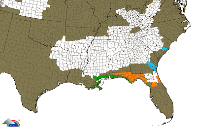
Winter storm watches are up for a lot of real estate. In the image below, all of the white counties from the Lower Mississippi Valley into the Carolinas are under winter storm watches.

My overall ideas have not changed. This should be a big winter storm for a good chunk of AR, MS, north AL, north Georgia, southern TN, and South Carolina. I feel like this will be a pretty significant event for at least southern NC, but the question marks get larger the farther north you go in NC due to uncertainty with precip amounts.
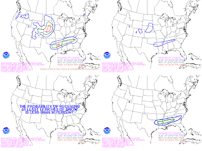
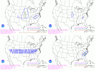
Below are the Day 2 and Day 3 winter weather maps issued this morning from the HPC.
Day 2

Day 3

Tidak ada komentar:
Posting Komentar